THE EQUINOX ALIGNMENT THROUGH THE AUCKLAND ISTHMUS.
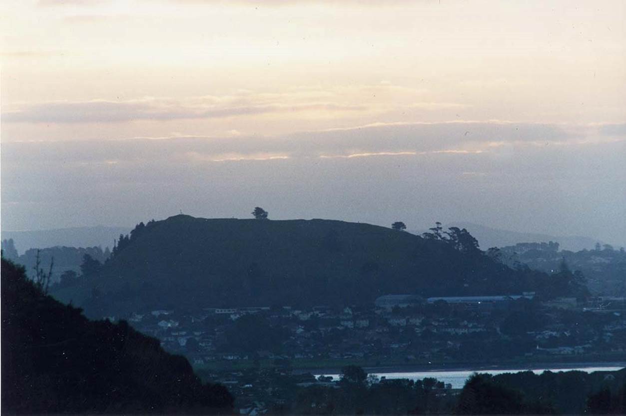
Sitting centrally on the top of extinct volcano, Mount Wellington is a trough depression to the right of the tree. This is actually a deeply dug ancient “V” excavation that now has a walkway platform running over it, significantly obscuring the depth of the “V” visually from a distance.
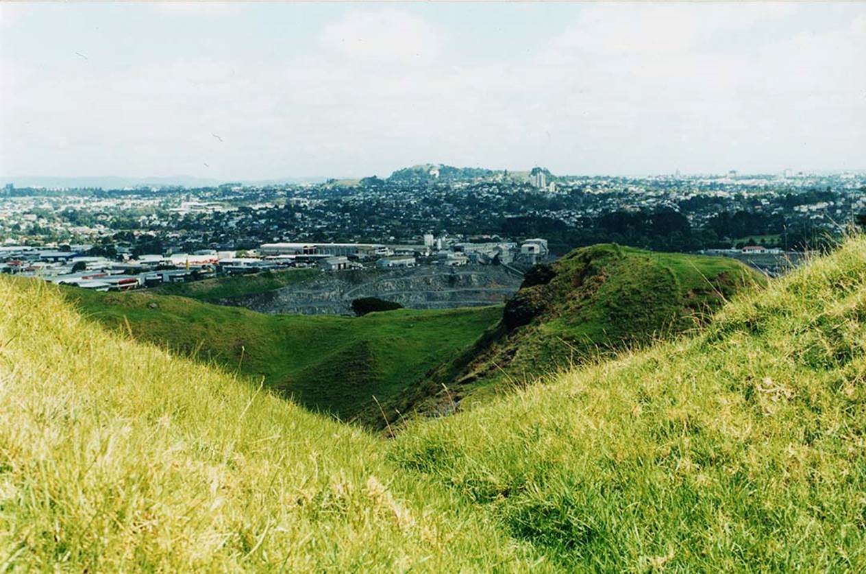
The actual “V” depression, below the modern walkway platform. In ancient times the gun sight-type “V” was easily seen from many miles distant. Immediately behind the “V” is the volcanic cone of the mountain and on the more distant horizon is Mount Albert, atop which sits an anciently-positioned marker stone that uses the Mount Wellington “V” to mark the sun’s rise on the day of the equinox.
But this solar alignment is dual functional and works to mark the equinoctial sunset as well.
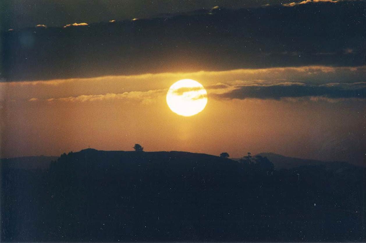
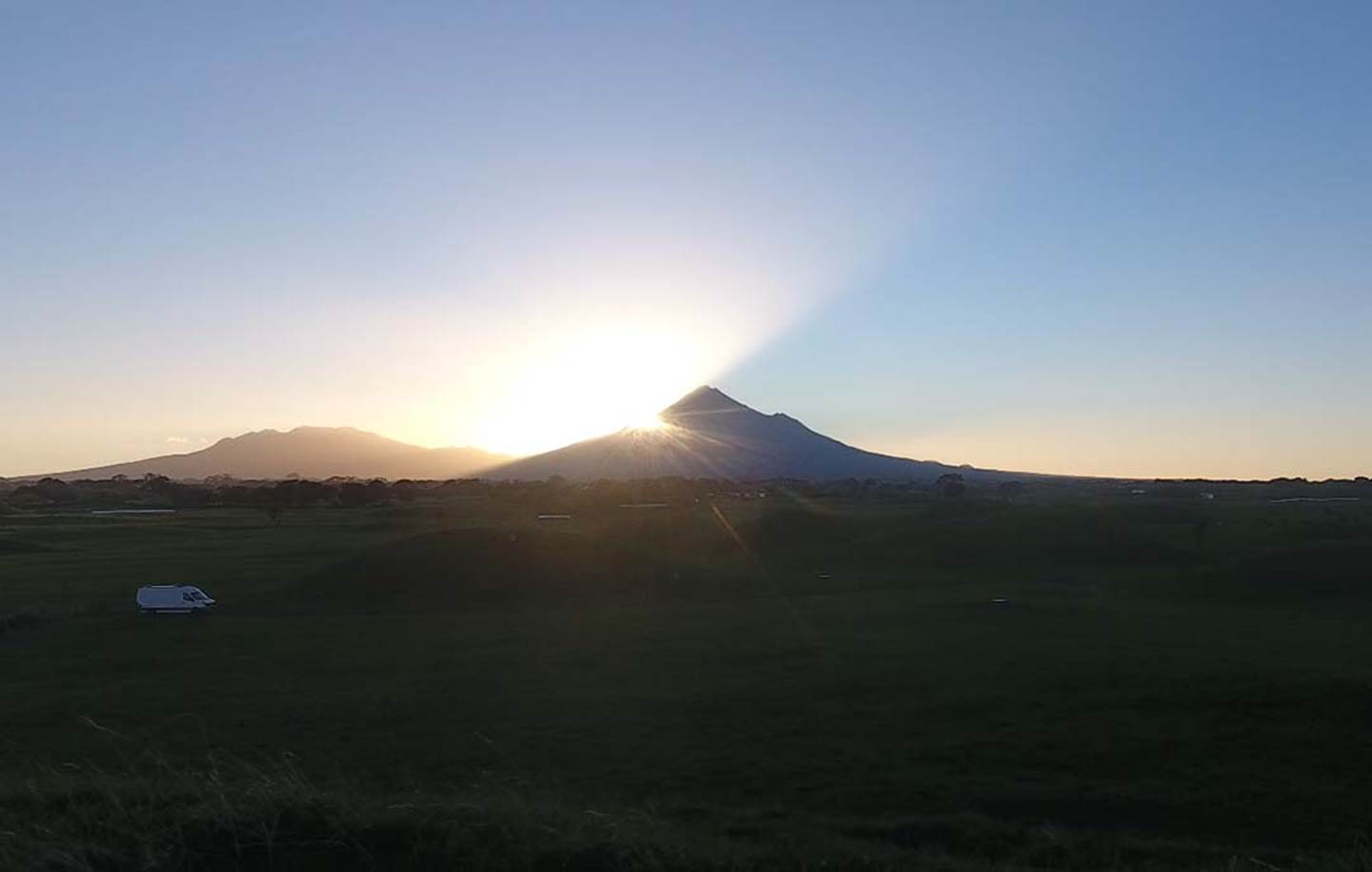
Here is the equinoctial sun descending onto Mount Wellington, as viewed from Stockade Hill solar observatory, 5-miles further to the east. Stockade Hill was once marked by standing stones on its crown, but these were removed in the mid-nineteenth century in order to build a military stockade.
In this picture the sun, alighting onto the crest position of Mount Wellington, hovers centrally over the “V” depression, before descending diagonally to the left.
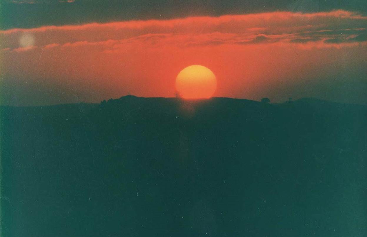
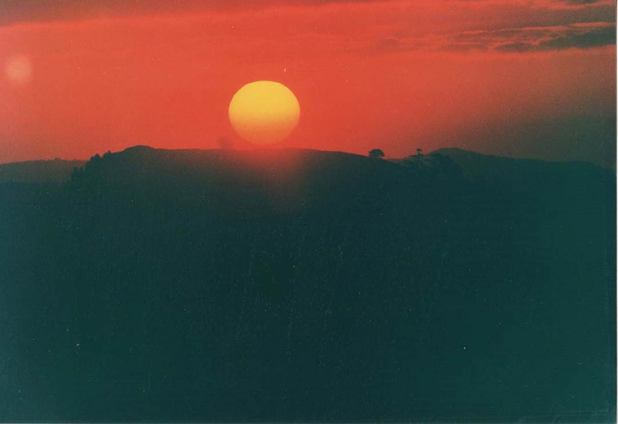
The right side of the alighting sun is now sinking into the “V” trench.
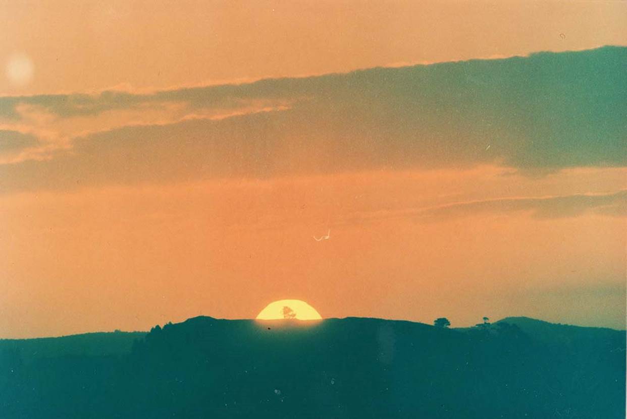
The sun now descends into the former volcanic crater, thus returning fire to the volcano. The “V” depression can be clearly seen to the right of the sun’s orb and, moments before, was aligned with the base of the alighting equinoctial sun. To the far left (Mount Wellington’s southern end), there’s an ancient mound. It is a component part of a straight-line mapping alignment that runs from the far north of New Zealand for hundreds of miles to Lake Taupo in the central North Island.
This anciently created equinox alignment runs for 11-miles across the Auckland Isthmus, New Zealand and continues to work flawlessly from each end (east or west) for rise and set fixes at the equinoxes. The surveyor-astronomers who calculated out and built this complex millennia-ago were very adept in the execution and implementation of their art.
TONGAPURUTU CAVE
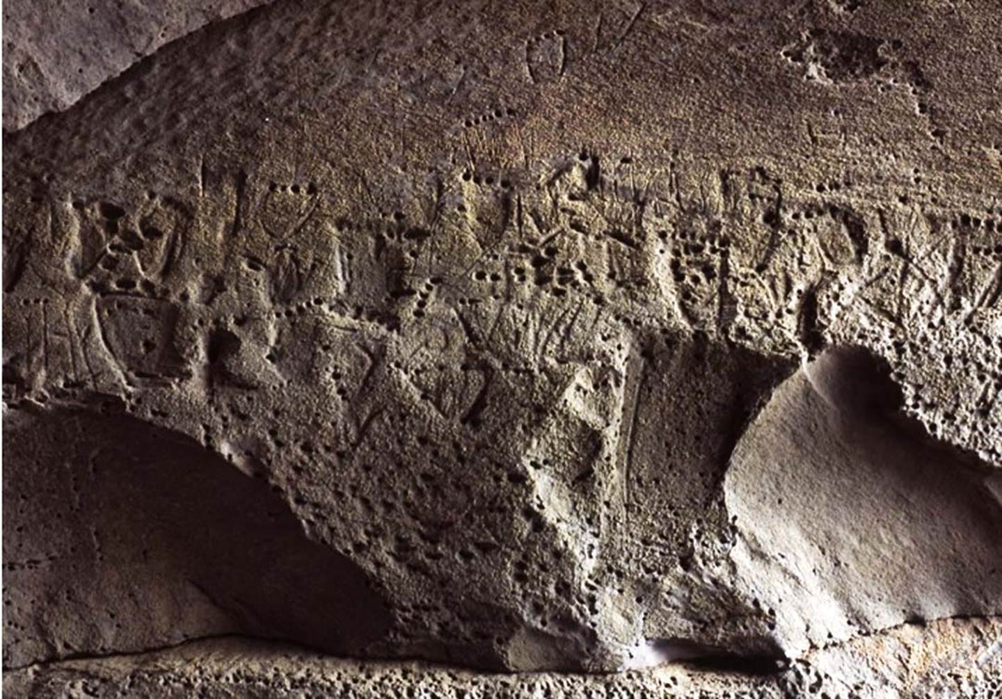
At Tongaporutu, Taranaki there are the remnants of famous rock carvings of “feet”, showing counts of toes ranging from 4 to 6 per foot. The ancient arrangement could infer some kind of a counting system. Our archaeologists don’t seem to realize that the adjacent cavern, with the rock carvings adorning the outer wall, faces the position of the summer solstice sun as it descends and sinks into the ocean.
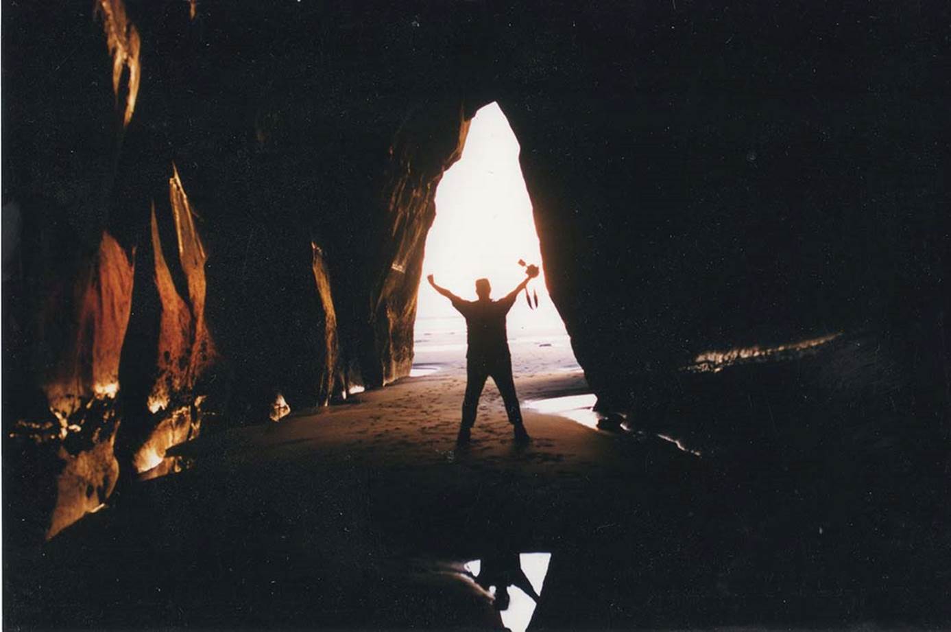
Archaeology researcher, Brendon stands near the cave entrance with the summer solstice sun alighting upon the sea directly behind him. There are many such natural sea caves in the area, but this one was, seemingly, chosen for the carvings because it gave a precise calendar fix on a very important solar event … just like at New Grange, Ireland where the sun enters a cavern corridor to accurately signal the winter solstice. In fact, the event in New Zealand (the Southern Hemisphere’s summer solstice and longest day) occurred on the same day as at New Grange (the Northern Hemisphere’s winter solstice and shortest day). Perhaps the Tongaporutu carvings should have been carefully assessed for shadow play over their surface on the day of the summer solstice.
The carvings seen above were destroyed by high seas in May 2007. Local Maori spokespeople admitted the carvings were thousands of years old and stated: "They are the last signs of what we know as te kahui potama, which are the ancient people and they were known as the maeroa." See: http://tvnz.co.nz/view/page/423466/1219118 (original link now seems to be dead).
THE TARANAKI LAHAR MOUNDS
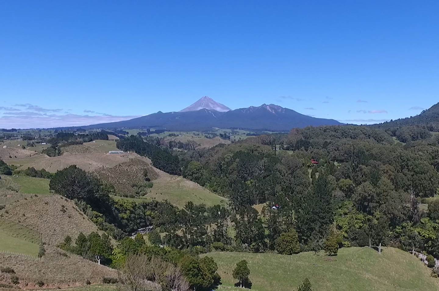
On the western coast of Taranaki province, west of Mount Taranaki itself, are many lahar volcanic up thrusts that, these days, look like grassed over earthen mounds. Their presence attests to the fact that the entire region was once a seething cauldron of volcanic activity, as the lahar humps were once molten lava thrust upwards under immense pressure, before cooling and solidifying into miniature or large, rounded hillocks of solid rock. In a wide sweep from the northwest to the southwest of majestic Mount Taranaki these lahar humps are everywhere distributed in their thousands.
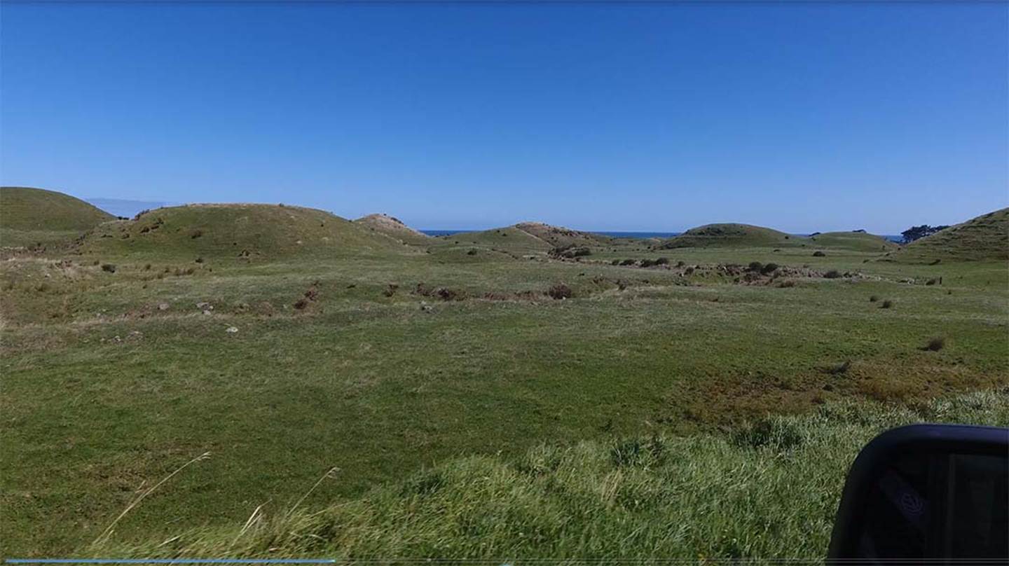
In the southwestern Taranaki region, there would be several hundred square miles of these lahar up thrusts of volcanic basalt. They now have thick humus and grass overlaying them, but underneath they are solid rock.
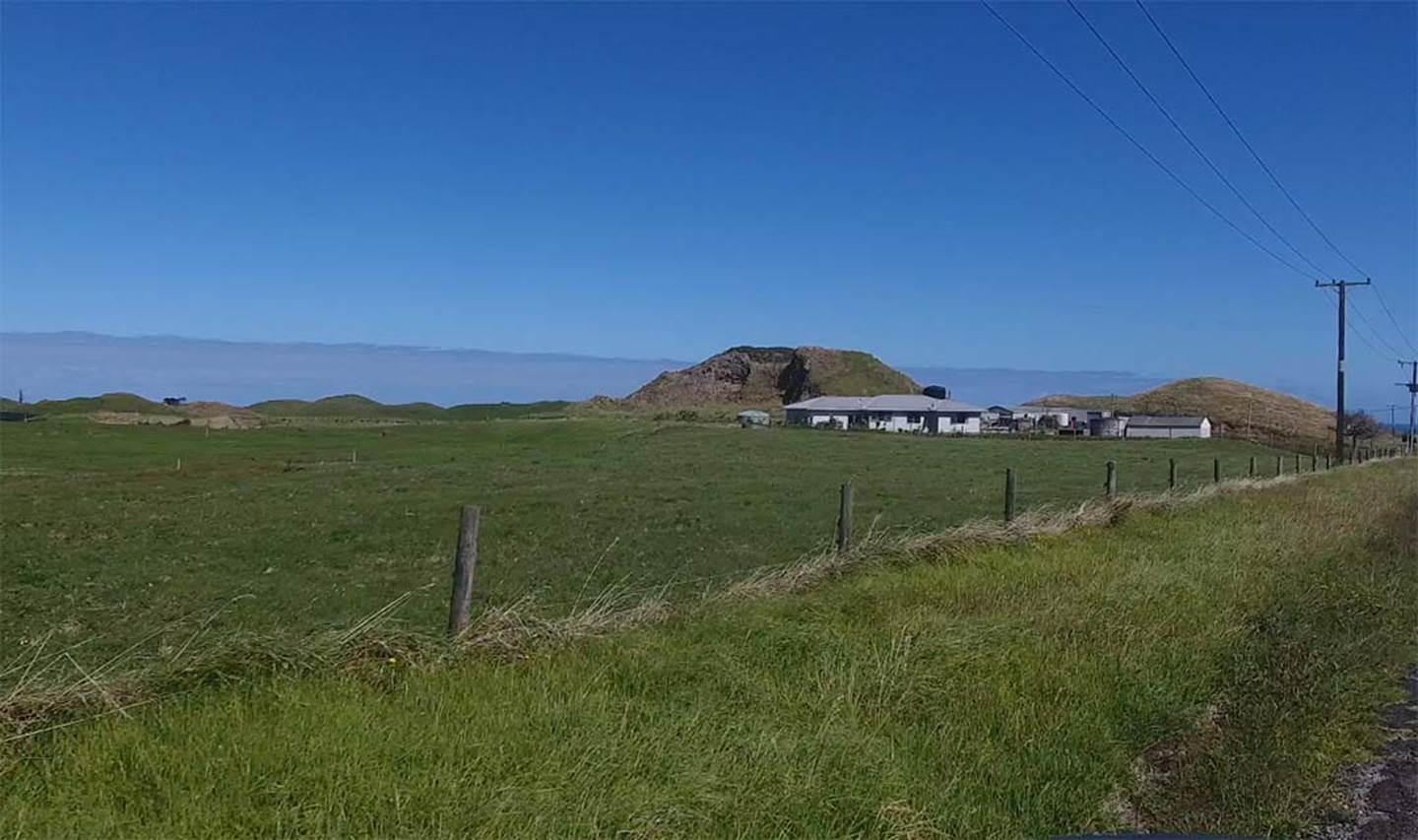
This large lahar has been turned into a quarry for high quality farm roading and attests to the fact that the lahars are solid rock, volcanic up-thrusts with a soil topping. They make excellent wind breaks for sheltering cattle or sheep and are often topped by farm water tanks. In most instances, animals can easily climb them and graze all over their surfaces and the humps appear to be more of an asset than a liability to farming in the district.
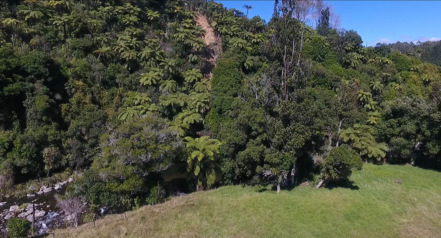
The innumerable, everywhere present lahar mounds offered a unique opportunity for ancient New Zealand surveyor-astronomers to set up special solar observatories or surveying sites across the wide terrain and specially chosen lahars were modified by them for this purpose. Generally, these special living sites were by a water course and the hillocks were laboriously carved into tiered terraces to form village complexes. The work undertaken to modify these hillocks into long-term living sites is astonishing.
Here are some examples:
The ancient Patu-paiarehe or Turehu people, who occupied New Zealand for thousands of years before the arrival of the Polynesian-Melanesian Maori people of the Pacific were adept surveyors and astronomers and, in every section of the country where they dwelt in sizeable numbers, would set up accurate solar observatories or overland mapping alignments.
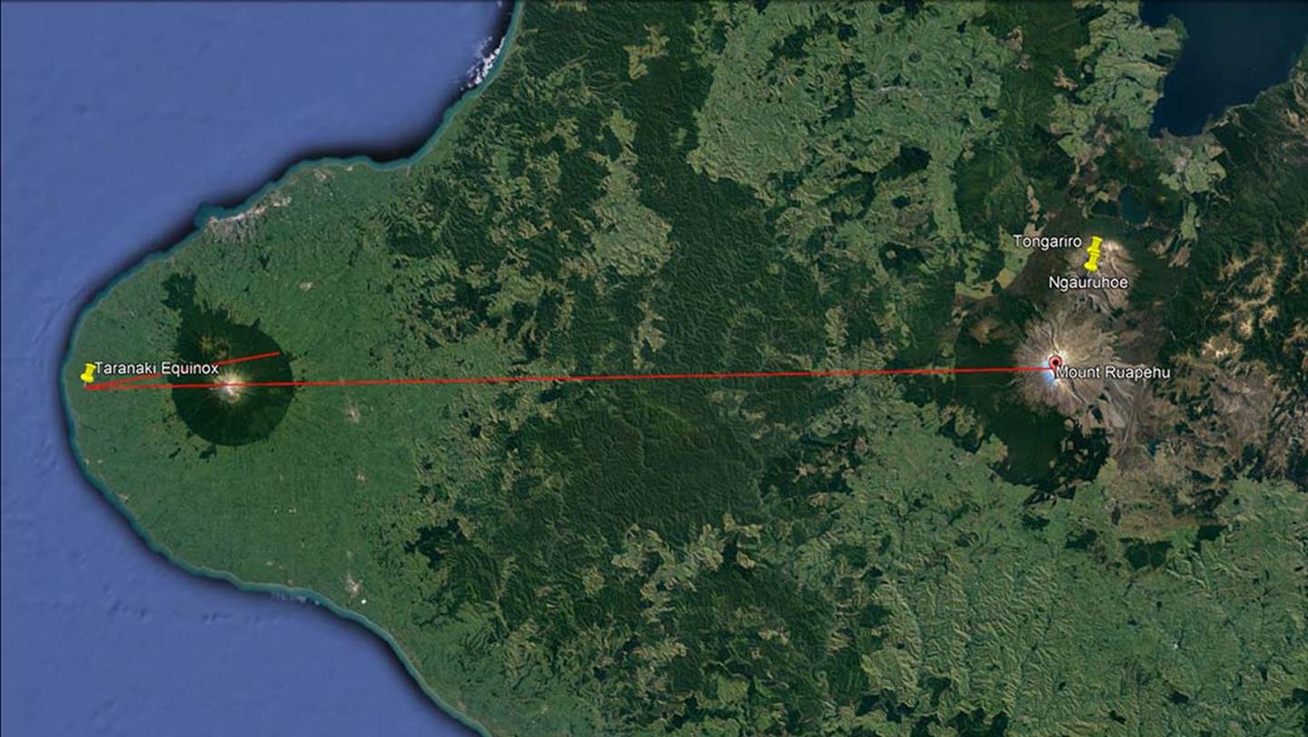
Because majestic Mount Taranaki represented both their highly venerated thunder & lightening god, Taranis-Taranaich, and a major landmark that could be seen from vast distances away across the country, it was used as an outer-marker. In the above picture, the ancient inhabitants chose a perfectly situated lahar complex that sat precisely due west of the mountains peak and the line, running at 90-degrees, also traversed the peak of Mount Ruapehu in the central volcanic plateau of the island. At the same time, their lahar position orientated onto the equinox “first-glint” of the rising sun, situated on the northern slope of Mount Taranaki.
Out of thousands of potential lahar humps to choose from, the ancient astronomer-surveyors chose this one because of its positional attributes. The line from this spot traverses the highest point of Mount Taranaki at 90-degrees or due east and the same line then resolves upon the high peak of Mount Ruapehu further inland. At the same time, they could observe the precise “first glint” of the equinoctial sun on a particular geological feature (hump or dip) that could repeatedly be used at every subsequent equinox sunrise. That spot on the northern edge of the mountain would herald the day of the equinox forevermore for their community.
The methodology used here by the ancient surveyor-astronomers of south Taranaki perfectly duplicates the modus operandi at the Waitapu Valley, Northland. From the standing stone array at Waitapu, the “V” dip in the landscape marked 90-degrees, whereas the equinoctial sun’s first glint was to the left on the top of Tutamoe Range. In both instances it was known that the position of sunrise on the sea horizon was at 90-degrees, but then the sun had to climb on a diagonal angle to the north, through high inland terrain to finally emerge several degrees further towards the north. This knowledge, in and of itself, was highly valuable to overland mapping and surveying and the sun’s positions of rise and set were invariably used in accurate overland mapping incentives.
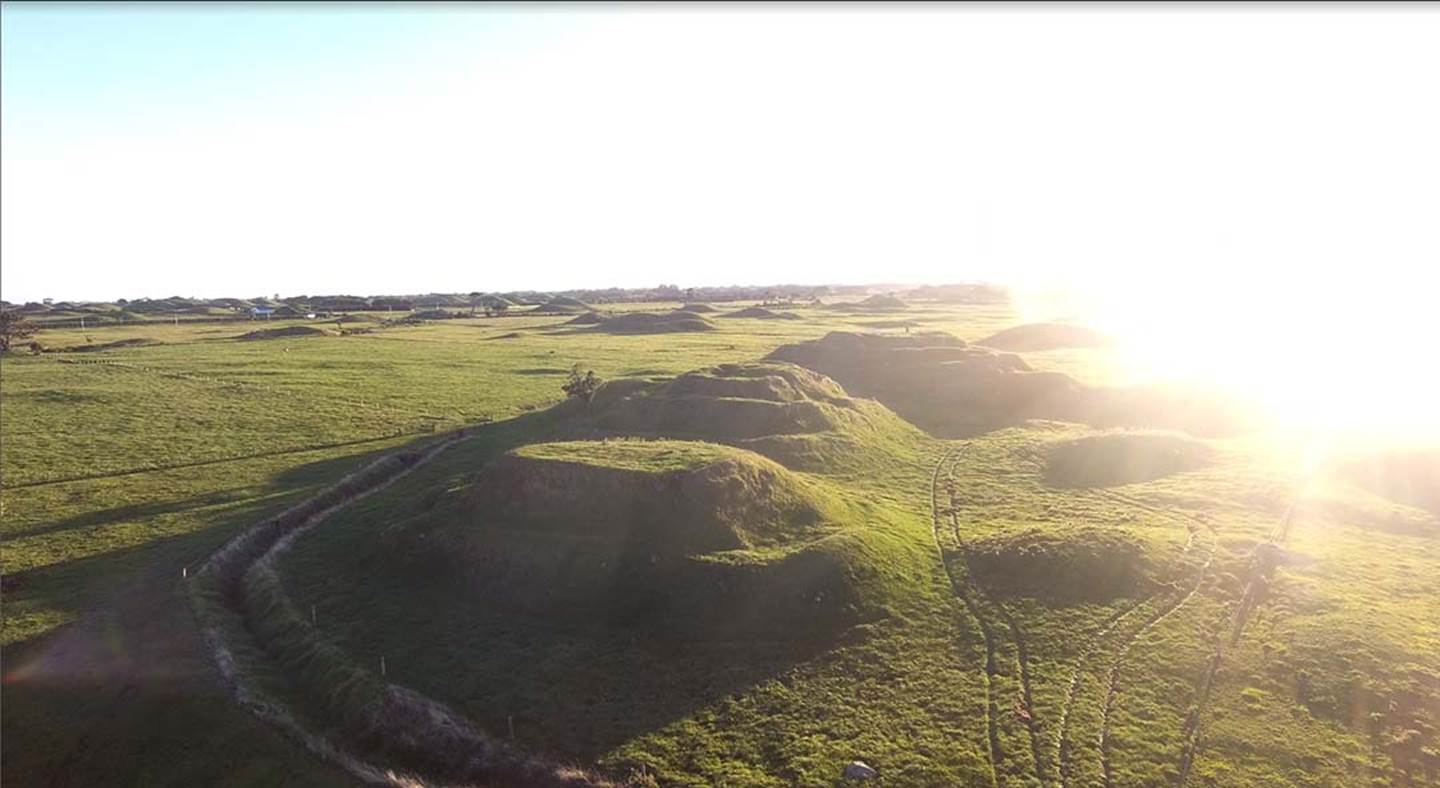
And here are the highly carved, triple lahar mounds basking in the blinding light of the equinoctial sunrise. Many more unmodified lahars dot the landscape for as far as the eye can see in every direction.
The most eastern of the 3-mound village complex, from the top of which we shot the sunrise. We had found the site by calculating what purpose modified lahar complexes sat due west of Mount Taranaki and later gained permission from the farmer to video from the site. Prior to that we had no knowledge that this site existed. It was only found by calculating where it should be then searching the terrain in Google Earth.
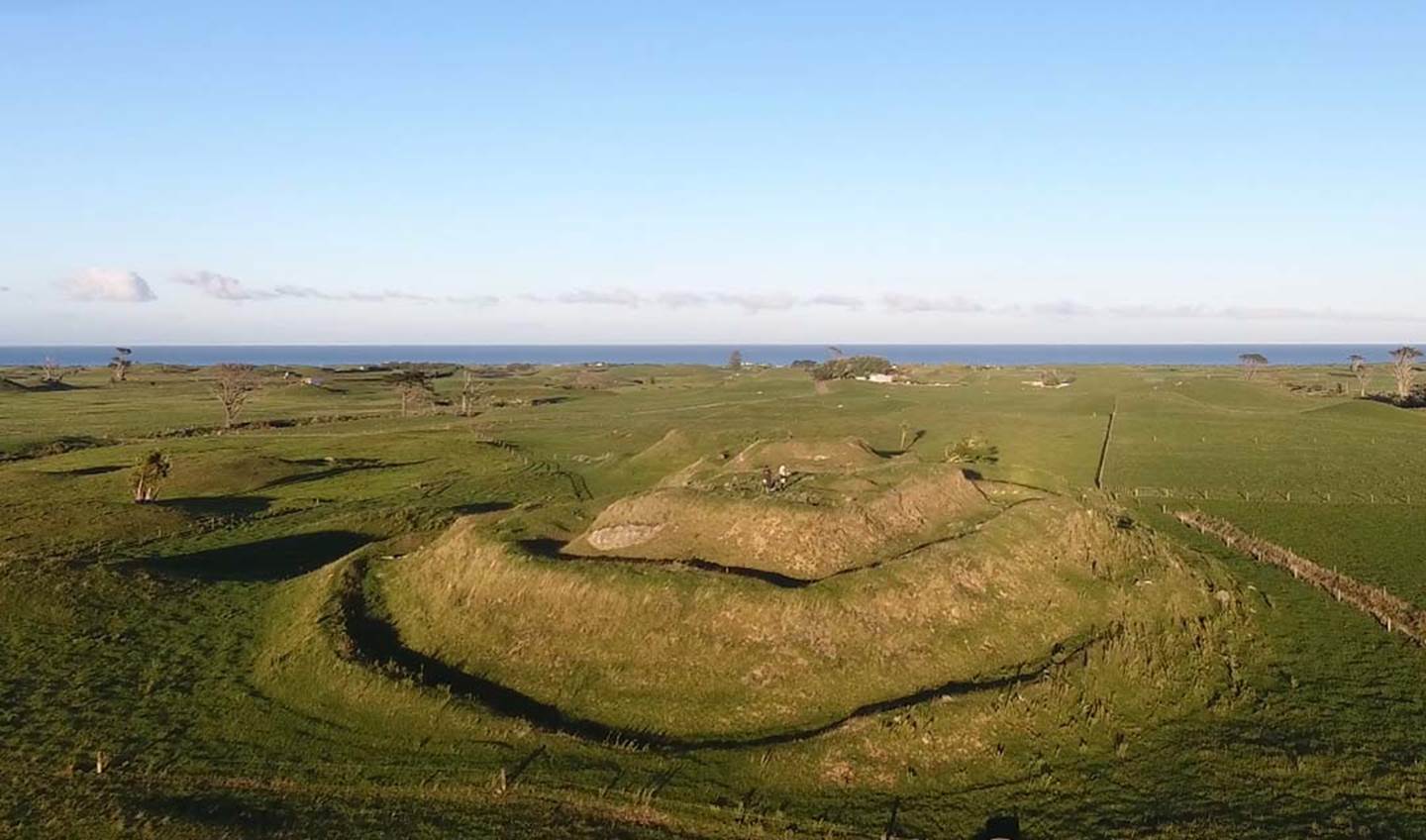
It is difficult to categorise these laboriously carved and tiered structures as fortresses. The ring walls seem too low to act as any serious deterrent to the unwanted intrusion of an enemy and there’s no evidence that log palisade walls were ever erected on them.
The circuiting ring ditches may only have acted, primarily, as wind breaks that inhabitants could shelter behind. souterrain caverns or tunnels within the structures were the probable domiciles in which the inhabitants lived out of the elements.
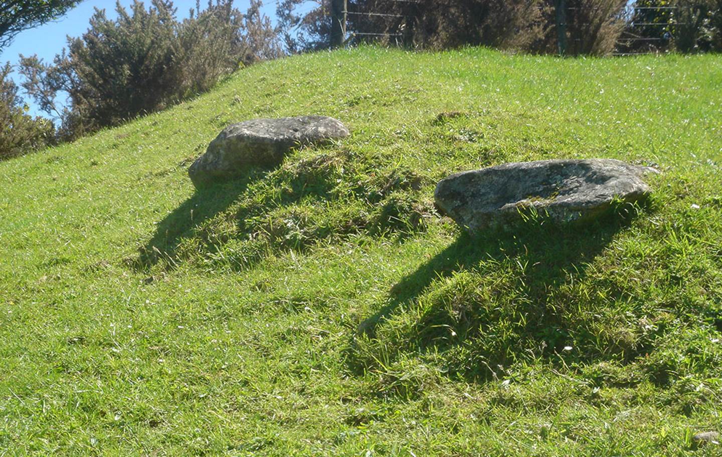
Strangely, the ring ditches, on each tier once had standing stones erected within them and one arrangement at this site forms a 3-part boulder arrow that points to the south. All around the structures is good arable land composed of rich volcanic soil, so growing kumara (sweet potato) or other staples would not have posed a problem. The close proximity to the sea would also mean abundant resources of fish, shellfish or seals.
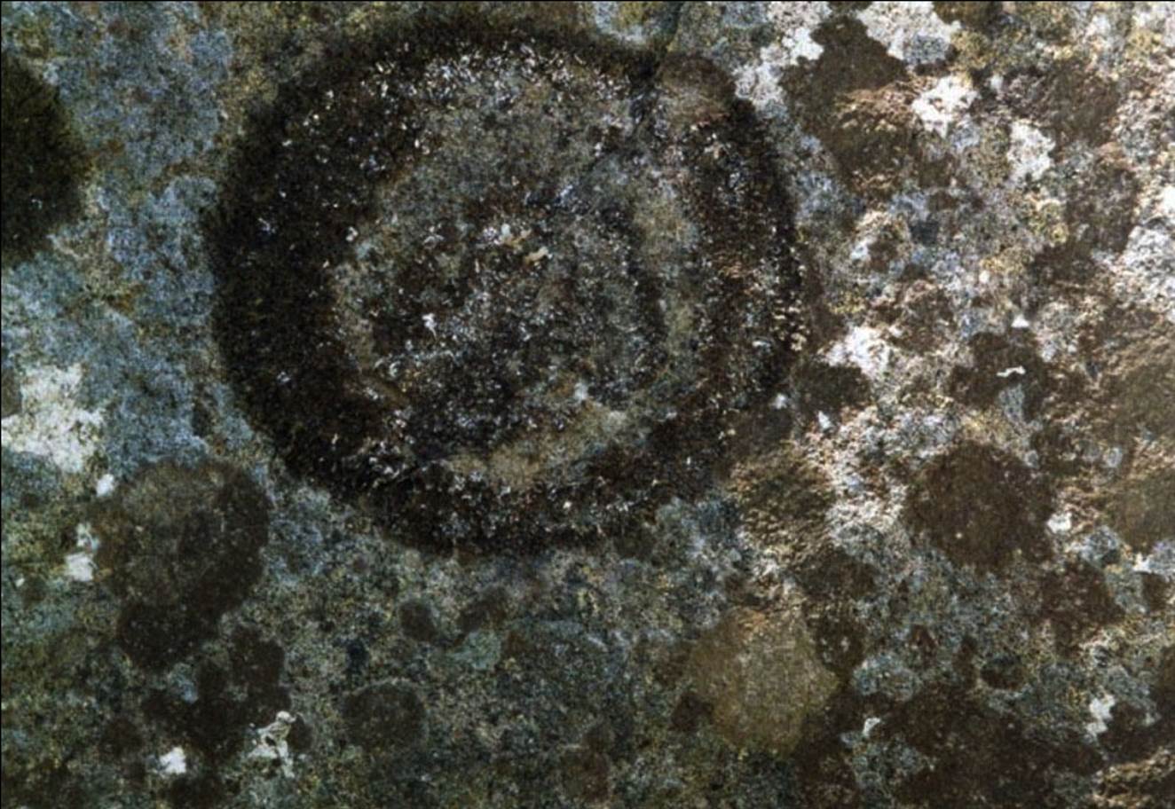
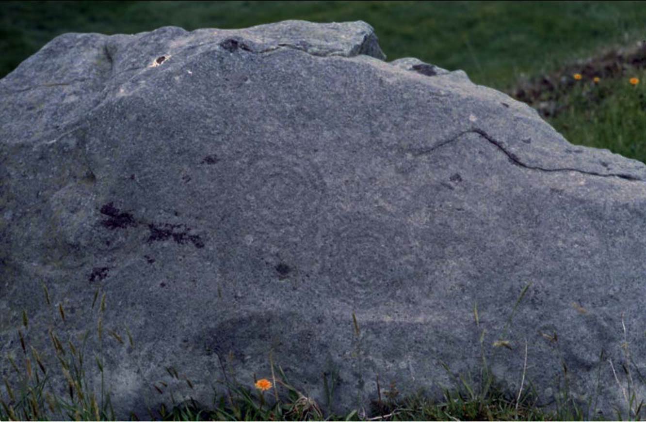
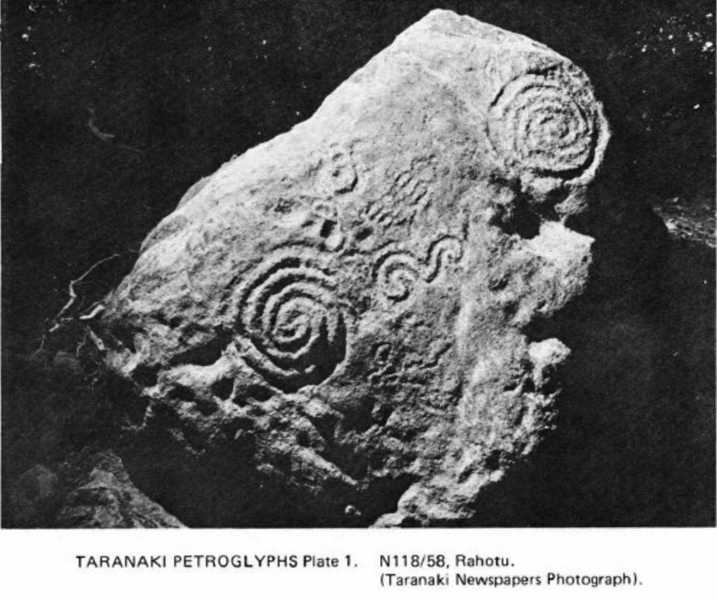
This petroglyph was found on a large boulder at the above site off Tipoka Road, Rahotu on the southern scarp of the ring-ditch. It is hard to read due to the thick lichen across its surface but appears to be a full circle with a central, partial spiral or circle design. It possibly related to the equinoctial solar orb being observed from this hillock, rising from Mount Taranaki. Other of the PA/solar observatories in the region also displayed spiral petroglyphs.
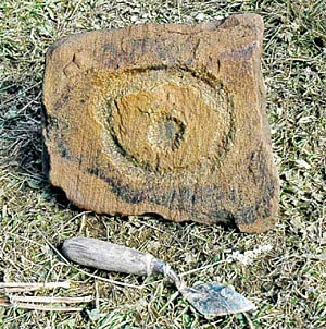
The Tipoka Road carved lahar petroglyph is remaniscent of the "Brodgar Eye" stone, located at Skara Brae, Orkney Islands, Scotland. It is thought to have been an equinox marker, illuminated when the equinoctial sun shone through the due east door into the (now roof-less) chamber.
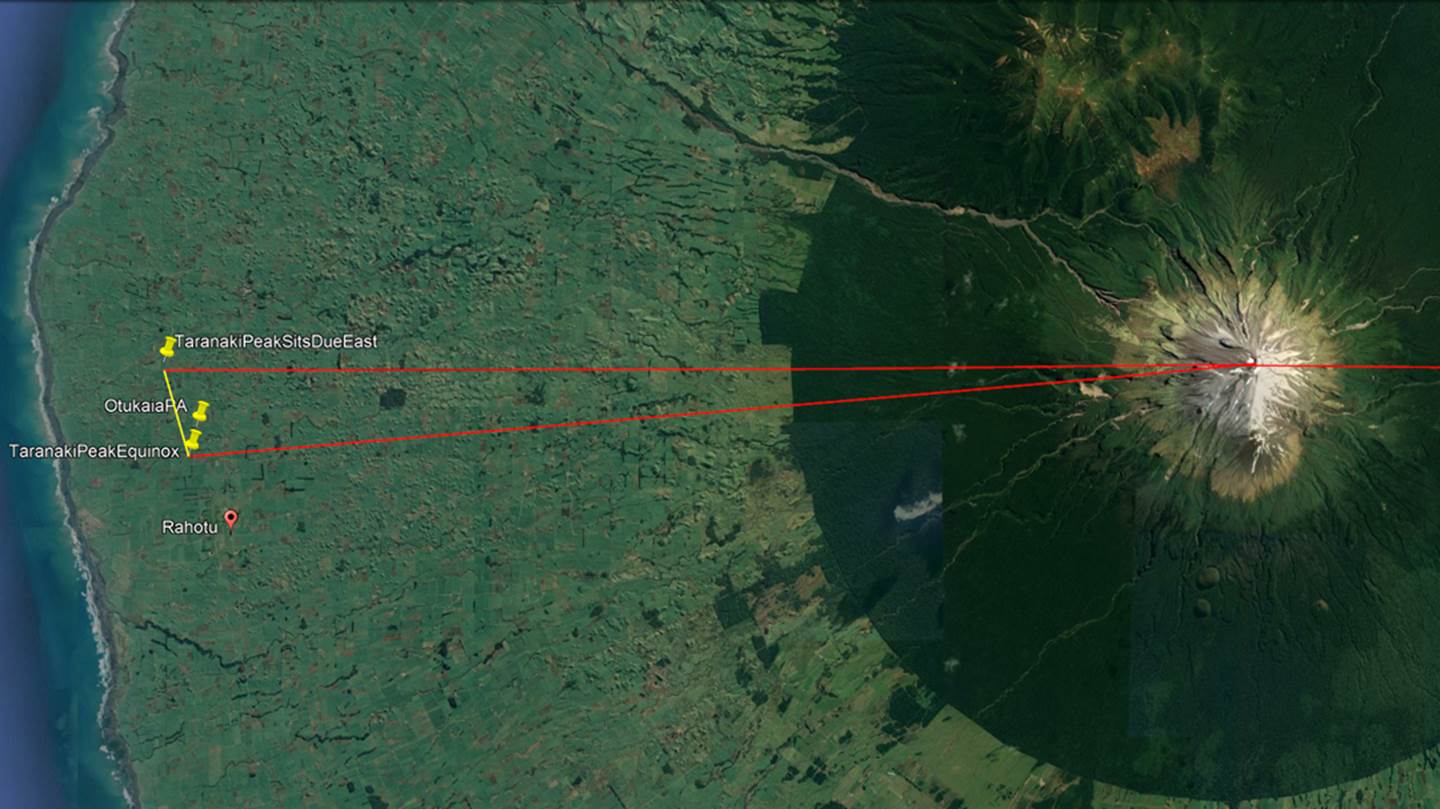
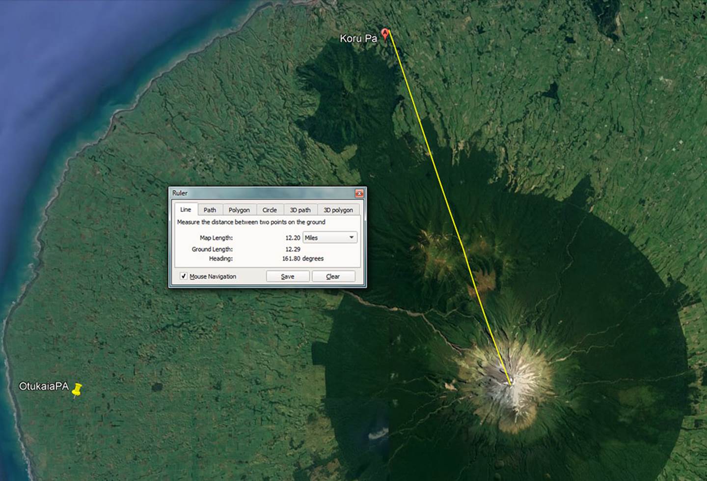
Whereas the site from which we videoed the equinox sunrise sat exactly due west of Mount Taranaki’s peak summit, another carved lahar site 1.27-miles southwards is where the observer sees “first glint” of the equinoctial sun arise on the peak of Mount Taranaki.
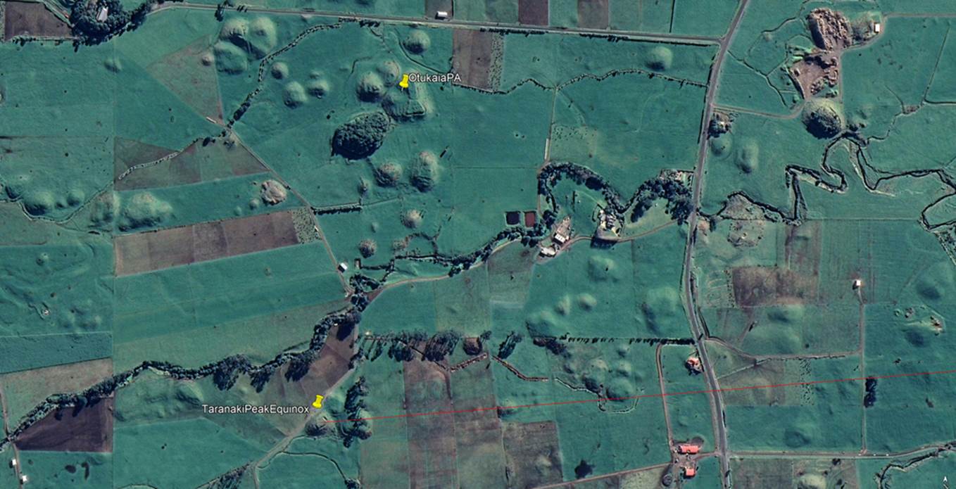
To the south side of Tipoka Road is Otukaia PA, which is listed in the archaeological literature as being a significant site. In its near vicinity are a number of carved lahar hillocks, one of which features a very substantial rectangular platform atop it and sits to the south of Otukaia PA. There is almost no archaeological reference to this site and little significance seems to have been attributed to it. However, it is very significant as an ancient solar observatory and village complex.
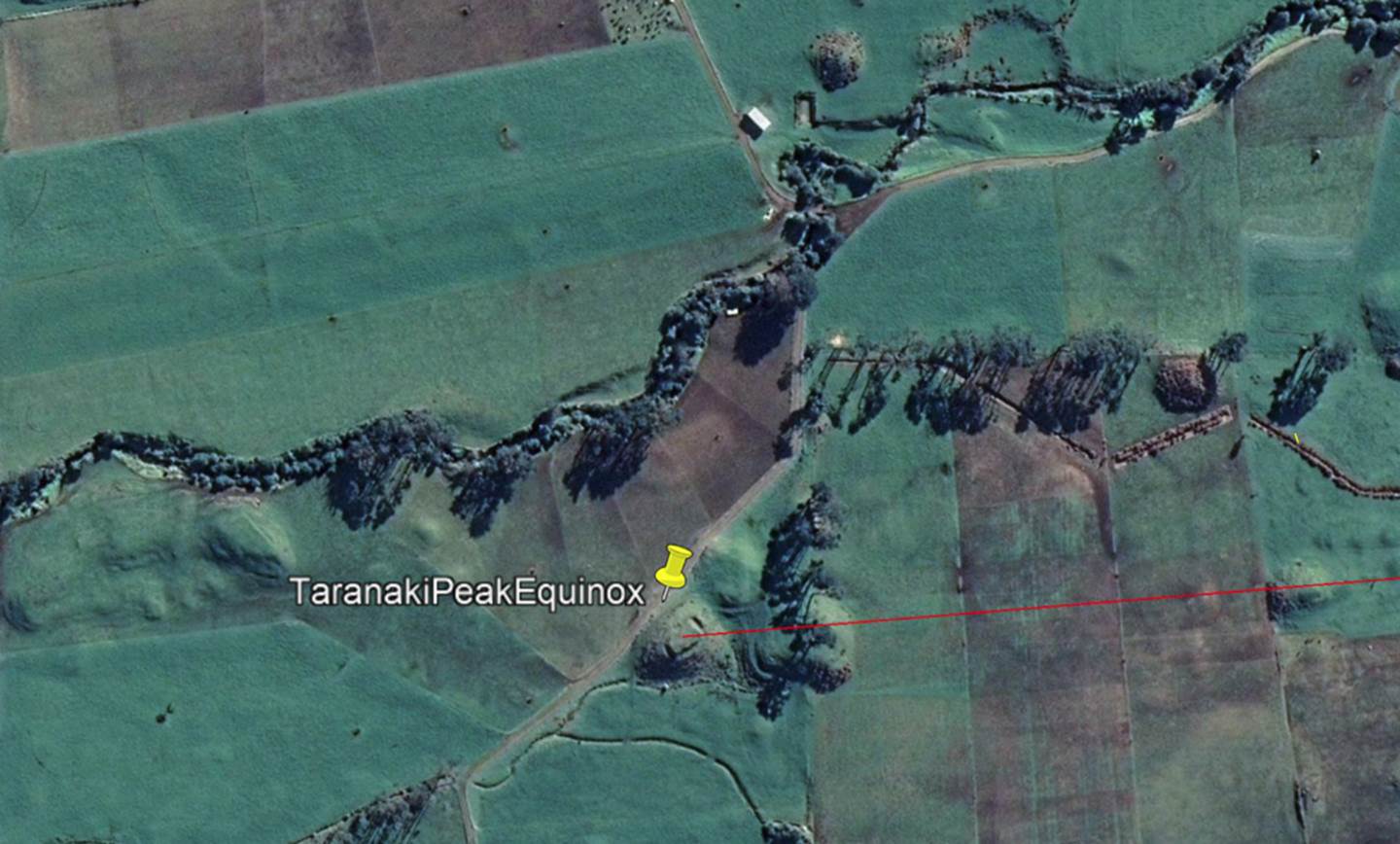
From this carved platform the ancient surveyor-astronomers could witness the sun rising from the highest summit point of Mount Taranaki. Alternatively, 1.27-miles away to the NNW the observation platform atop a substantially carved lahar sat due west of the summit peak. The measurable distance between the two points could represent a surveyor’s baseline of known length, then by knowing the sun’s angle of rise at the equinox, it’s angle where “first glint” on the mountain occurred from both locations, as well as the angles to the peak from each platform, all manner of trigonometric calculations or land-mapping opportunities, using the equinoctial sun, would avail themselves.
It's evident that a formerly large, ancient population inhabited the Rahotu region, based upon the number or concentration of laboriously carved lahar hillocks, complete with souterrain domiciles for underground living and food storage.
The very faint, well-weathered spiral incising from a boulder found on Ruatupupaku PA. Due to the fact that these incised boulders are invariably very hard basalt the degree of weathering would infer great age.
Spiral stone at Tarakihi PA, Warea – Pungarehu, just north of Rahotu.
Also, in the immediate district is this faint, much weather-worn and enigmatic petroglyph on Puniho Marae, Warea. It was supposedly found abandoned in a local river and could be thousands of years old.
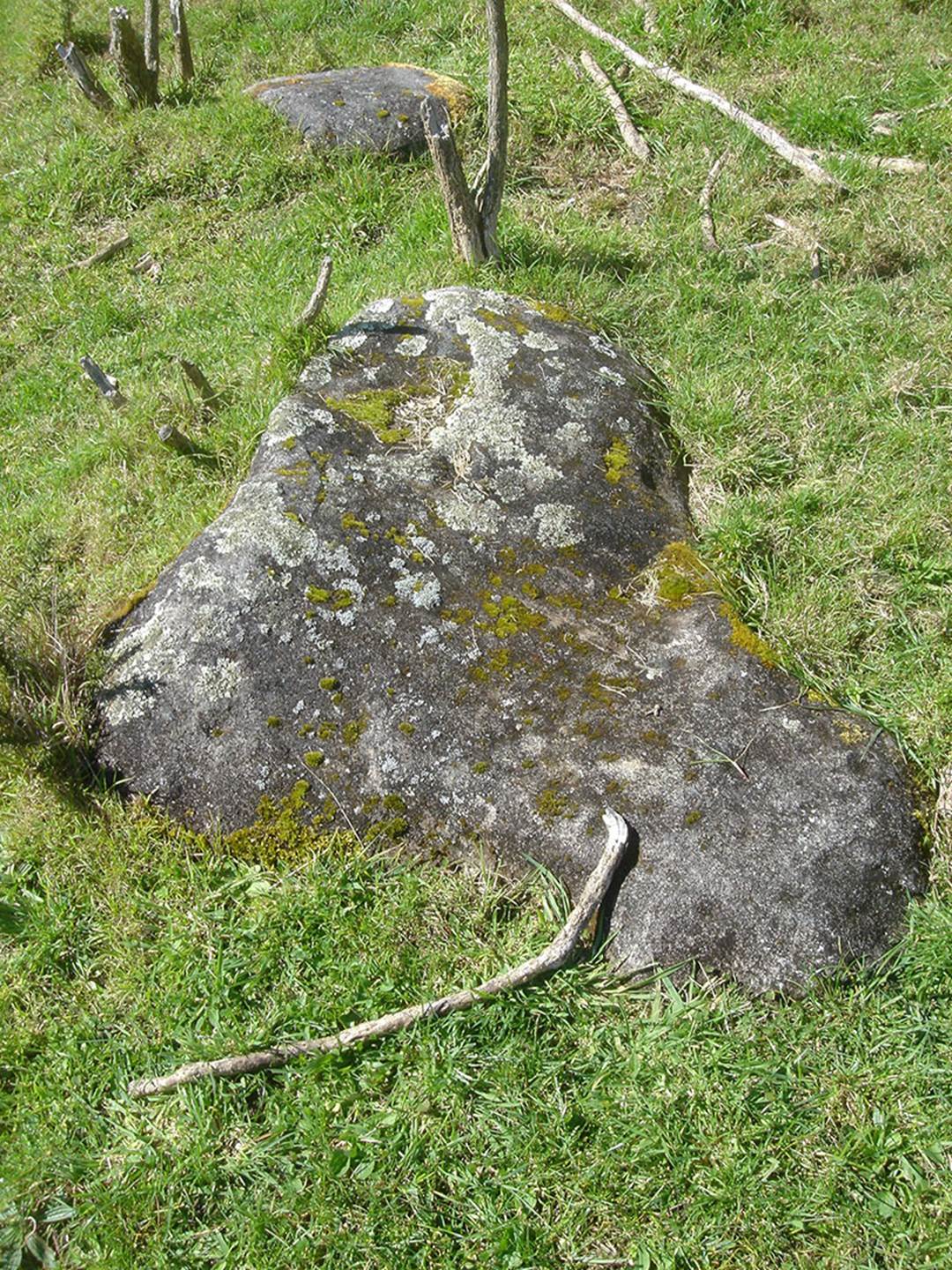
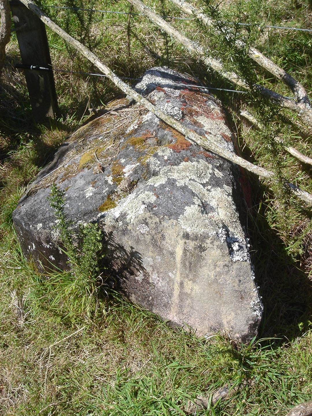
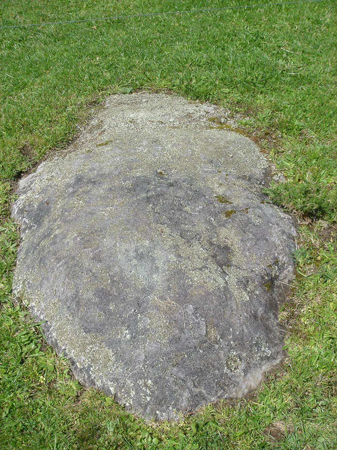
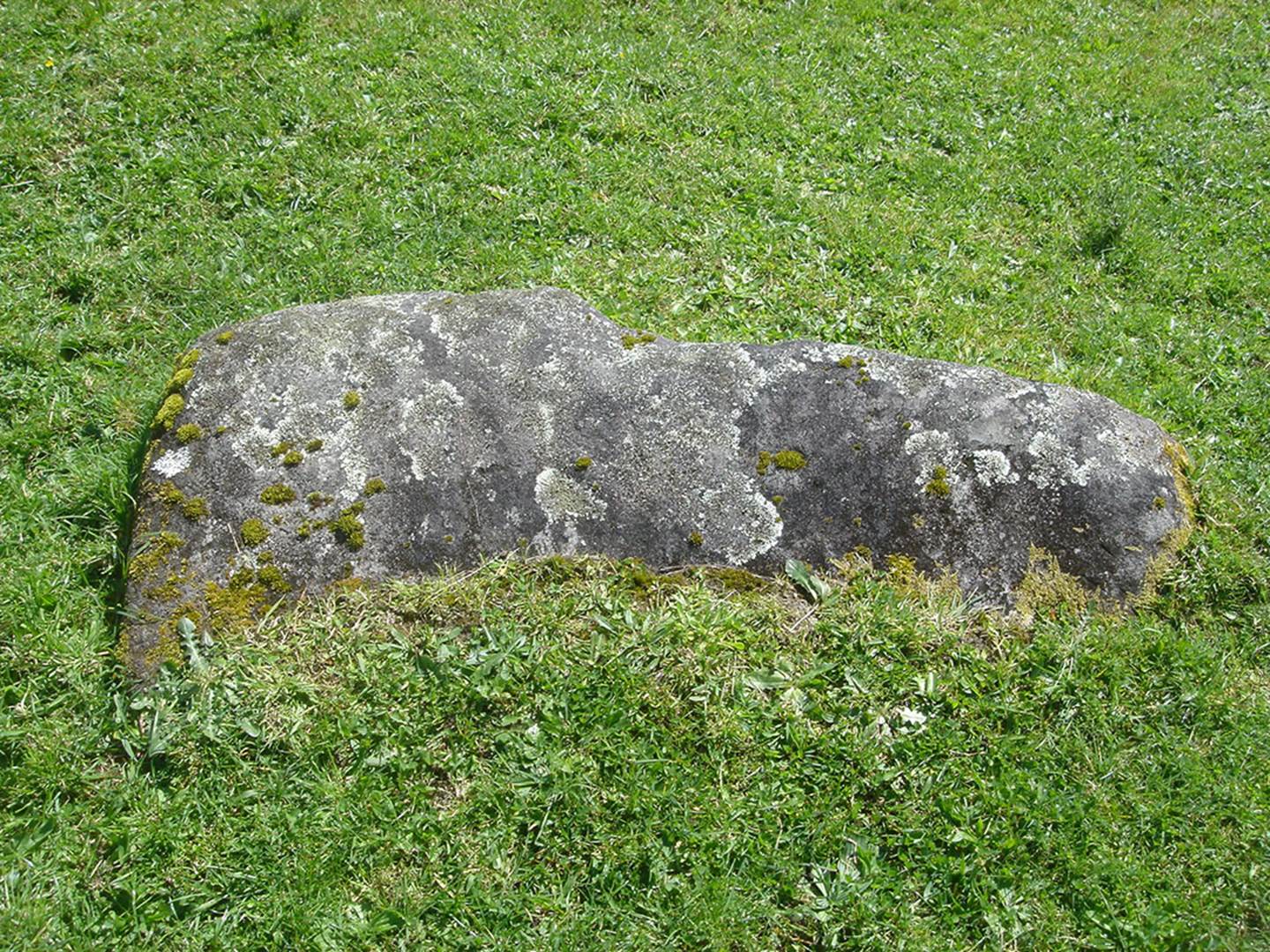
At Rahotu township is a very ancient, large lahar set of 3 hillocks, that were highly carved for a village community. The location is called Puketoretore. The complex was abandoned a very long time ago and is now mostly covered in large trees.
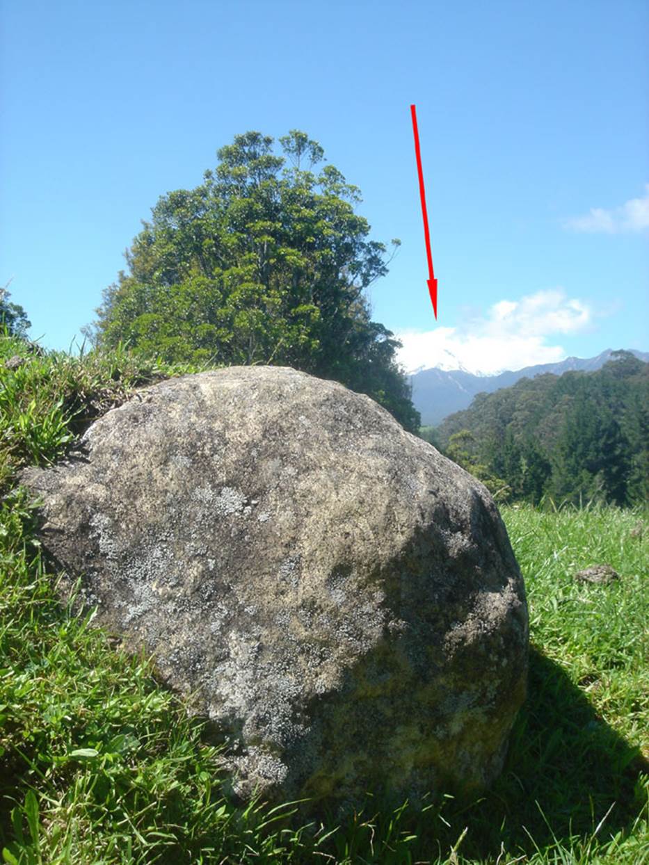
At the southern side of the complex ancient surveyor-astronomers built a specialised mound, marked on each side by standing stones. This small mound designated where the observer needed to stand in order to witness the equinoctial sunrise up the southern side of Mount Taranaki. The modus operandi used was exactly the same as that of the ancient Ngati-Hotu people of Taupo, wherein, from their observatory hubstone position, they had used the southern base of Mount Maunganamu (mountain of the mosquito) as the first glint position, then had the sun climb the mountainside to launch itself into the sky. See: https://www.youtube.com/watch?v=-Ukl4lrGFXM
In the above picture, first glint of the equinoctial sun is at the southern base of Mount Taranaki at a point where the long incline of the mountain conjuncts with a mound in the foreground, forming a distinct notch. Throughout the year the notch would always represent the equinoctial fix point for the rising sun. The same method was used at Maunganamu mountain, Taupo, where there was a visible conjunction between the flat terrain at the base of the mountain and diagonal edge of the sloping face.
While videoing the sunrise at this location we were intrigued to see many large aircraft high overhead crisscrossing the sky and leaving long-enduring trails that fanned out slowly and never quite fully dissipated. After an hour or two the sky looked like a patch-work quilt ... Gee, I wonder what we noxious-pests below were being sprayed with?
A highly magnified view of Mount Taranaki at the time of the equinox, with the observer’s sighting mound position, marked by dual stones, to the right of the picture.
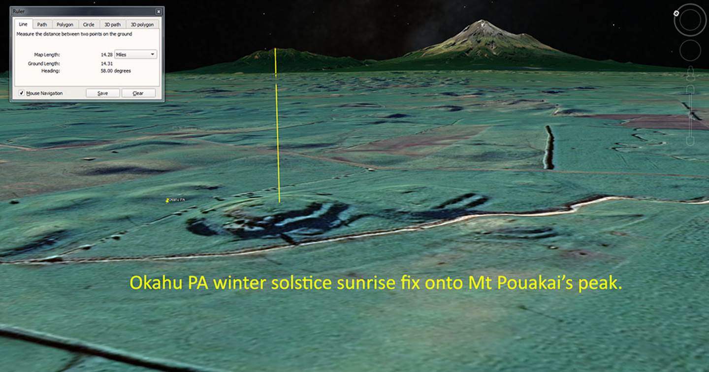
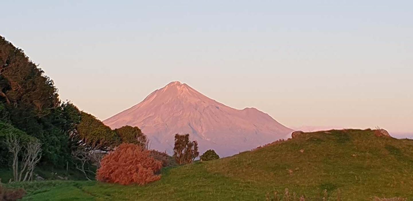
Yet another carved and terraced lahar volcanic up thrust, called Okahu PA, sits SSW of Rahotu township and Puketoretore PA. This strategically located hillock was anciently chosen as the observation position for getting an accurate fix onto the winter solstice sunrise, with “first-glint” of the sun occurring on the peak of the Pouakai Range.
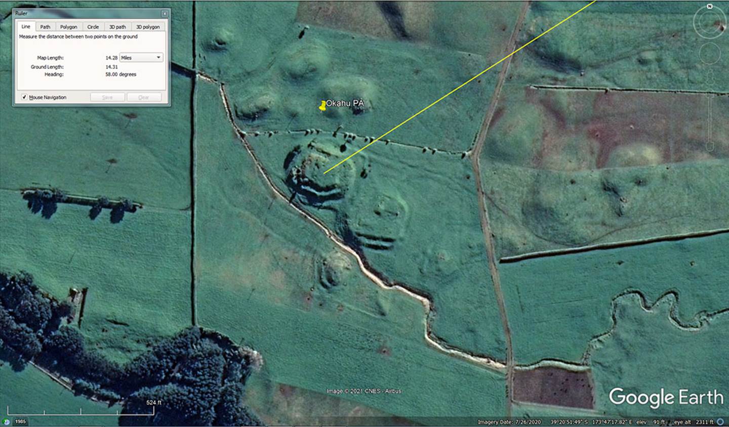
The yellow line scoots past the southern edge of Puketoretore PA to resolve upon the peak of Pouakai Range.
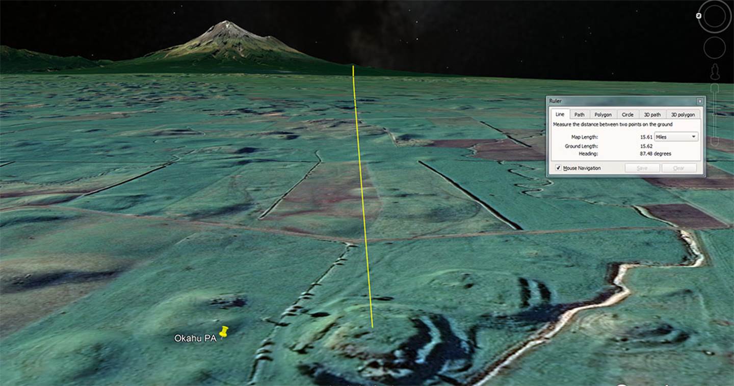
From atop Okahu PA, a hillock hump at the southern base of Mt Taranaki should give a precise fix onto the equinoctial sunrises, year after year. The local astronomer priest, very familiar with the regional terrain would know the exact hump or dip position where first glint of the equinoctial sun would occur. As with many other solar observatory sites, that exact rise position, from Okahu PA, is yet to be tested by on-site observation.
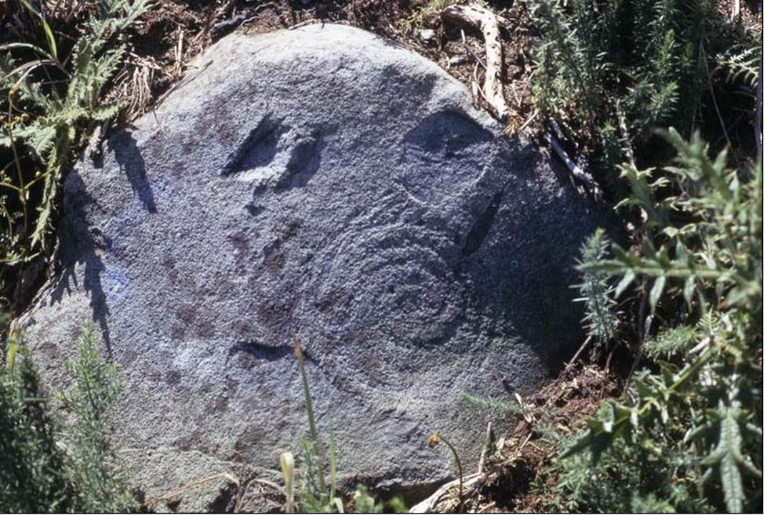
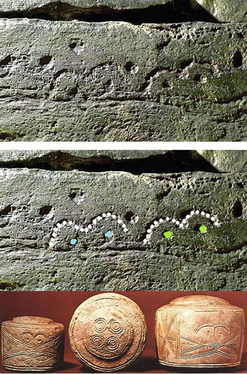
This very European theatre looking petroglyph was found at Puketoretore PA on a bank very close to the sighting mound. It undoubtedly represents the sun moving from its winter solstice position, crossing the central equinox position, then winding into its summer solstice position before returning to the winter solstice in the endless journey of RA or Rangi.
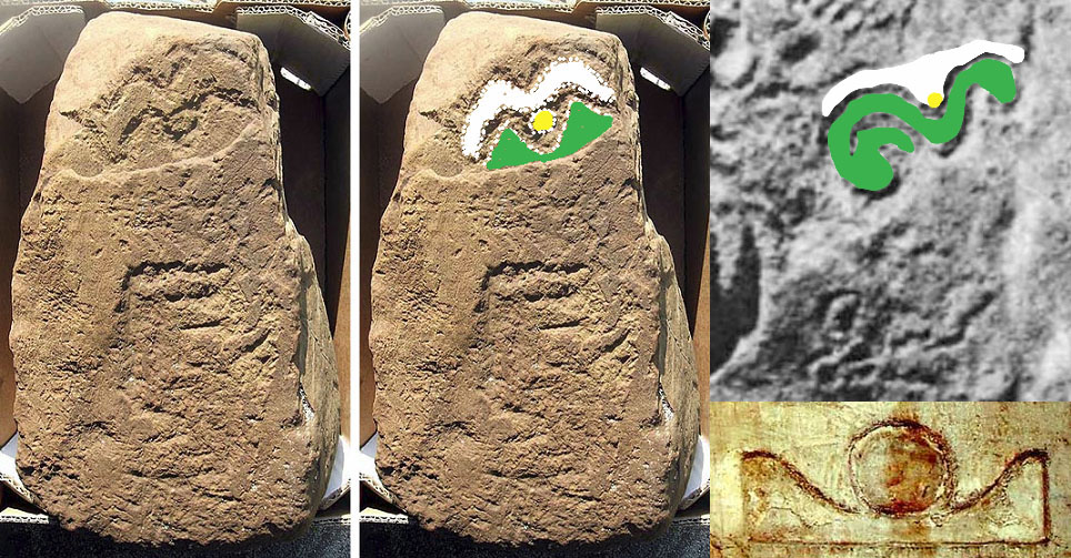
Carved into the central region of the stone, between the two spirals, is a design that could be compared to a moustach, eyebrows, rams horns or a bird in flight. It features a deep "V" like a gunsight and this symbol was much used from Egypt to Britain to New Zealand. Here are some very ancient examples from Northern England and the Orkney Islands of Scotland:
This is a much incised stone located in the Orkney Islands, which, in the head region, undoubtedly depicts a very significant solar event witnessed from the centre of Brodgar standing stone circle.
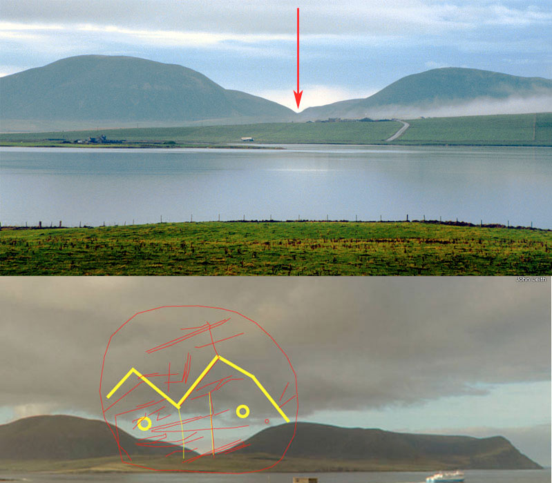
The ancient positioning of Ring o' Brodgar was absolutely tied to the "V" between Ward Hill and Cuilags Hill of Hoy Island, as that was the precise spot where the Sun alighted at sunset on the day of the Winter Solstice, as viewed from Ring o' Brodgar's centre. By taking an annual or periodic fix on this event in clear weather, ancient astronomer-surveyors at Ring o' Brodgar could keep their calendar running true, right down to the day, and all planting, harvesting or commencement of trans-Atlantic voyages could be undertaken on the optimum dates.
Brodgar Ring sits 35.4375-degrees (35 & 7/16ths) away from the trough of the "V" gap, formed by the declining ends of the two hills and the length of a lunar year is 354.375-days. Half the base length of the Khafre Pyramid of Egypt is 354.375-feet (354 & 3/8ths) or 206.25 Egyptian Royal Cubits.
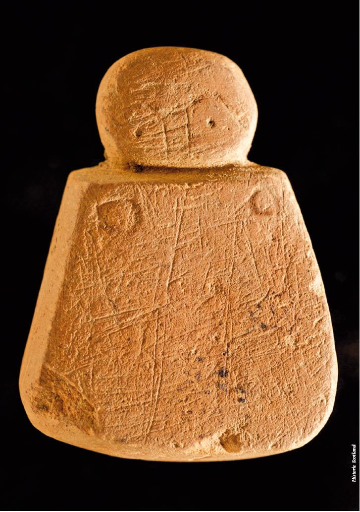
At Holm of Papa, chambered cairn, Westray, Orkney Islands the selfsame eyebrow and eye-dot cup depressions are found, as depicted on the "Brodgar Venus" statuette. The design is also duplicated on the Folkston Drums, made of chalk, which were found in a child's grave of the Wessex people of ancient England. Wessex graves contained pots with, what can be interpreted as, navigational geometry adorning the pots ... similar in concept to the Egyptian (Hypocephalus amulet) idea that the dead needed directional information to navigate to the heavenly home. In surveying terms, the "V" represented a significant target on the horizon or a position where an event (solstice-equinox) would occur.
Cultural symbolism half a world removed from each other ... a megalithic era stone from Papa Westray in the Orkney Islands of Scotland and a comparable, ancient execution of the same glyph design at a solar observatory found at Rahotu, New Zealand. At both locations the "V" trough seems to depict the solar orb at the equinox, with the outer wing points indicating the summer and winter solstice positions.
In the lower, right-hand corner is seen the Akhet hieroglyph of ancient Egypt which, Egyptologists translate to mean:
'Akhet is an Egyptian hieroglyph that represents where the sun rises or sets. It is translated as "horizon" or "mountain of light". Betro describes it as "Mountain with the rising sun" and an ideogram for "horizon"'.
This glyph depicts the sun rising in the"V" formed by two mountains.
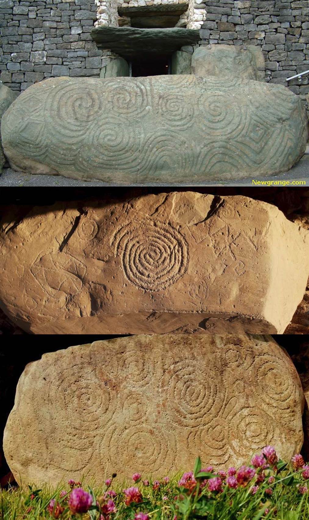
The spiral petroglyph found at Puketoretore PA, Rahotu is very reminiscent of similar spiral designs found in the kerbstone petroglyphs of Newgrange and Knowth, Ireland and dating to over 3100-years BC.
COMMUNICATED BY ELSDON BEST (Learned tohunga-priest who studied Maori lore under Maori-tohunga priests for over 25-years and had the title bestowed upon him):
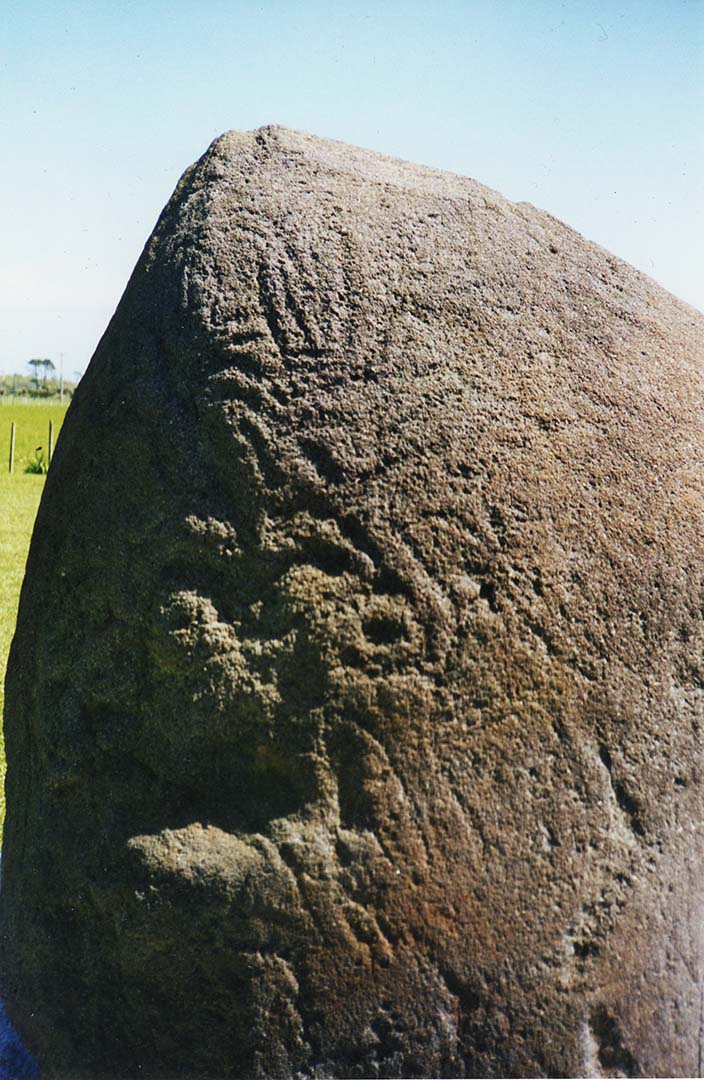
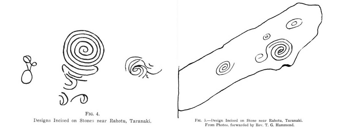
‘In that part of the Taranaki district lying between the Waingongoro River and Stony River there are a considerable number of stones showing such inscribed designs as appear in the illustrations given. Some, if not all, of these stones were held as tapu objects, and at them were performed certain rites concerning which we have gained but little information. The best known of these marked stones is that known to the Maori as the Toka a Rauhoto or Rock of Rauhoto, a large boulder near Cape Egmont.’
‘The most interesting of the stones mentioned by Mr. Hammond is one that stands seaward of Puniho. It stands about three feet high and on its seaward side are incised certain scroll-like designs resembling those of Maori tattooing. At this stone certain rites, of which we have no particulars, were periodically performed, and the stone was anointed with oil and covered with a garment at certain times when the ceremonies were conducted, also it was kept clear of lichen growth.
Mr. Hammond mentions other stones near Rahotu that have similar designs incised upon them (see Figs. 4, 5) and states that they were ahurewa i.e. tapu places at which rites were performed.’ See: http://www.jps.auckland.ac.nz/document//Volume_36_1927/Volume_36%2C_No._142/Notes_on_inscribed_stones_of_the_Taranaki_district%2C_by_Elsdon_Best%2C_p_137-140/p1
We now know that one of the rituals performed at these sites, where the spiral or similar incised stones are found (circles, etc.), was fixes onto the rise position of the sun at equinoxes or solstices, using Mt Taranaki as the back-drop, outer-marker. The Toka a Rauhoto or Rock of Rauhoto apparently identifies the name of the wife of Rua-Taranaki*, after whom Mt Taranaki is named.
*The name Rua-Taranaki , if translated using northern hemisphere meanings for Tara, Taran, Taranis or Taranaich (god of thunder & lightning) would mean “pit (crater) upon a high-place of thunder, fire and lightning flashes”. …which would also infer a fixed target or spectacle for sighting upon … solar rises on a volcano (that was the vicarious representation of the god of thunder & lightning).
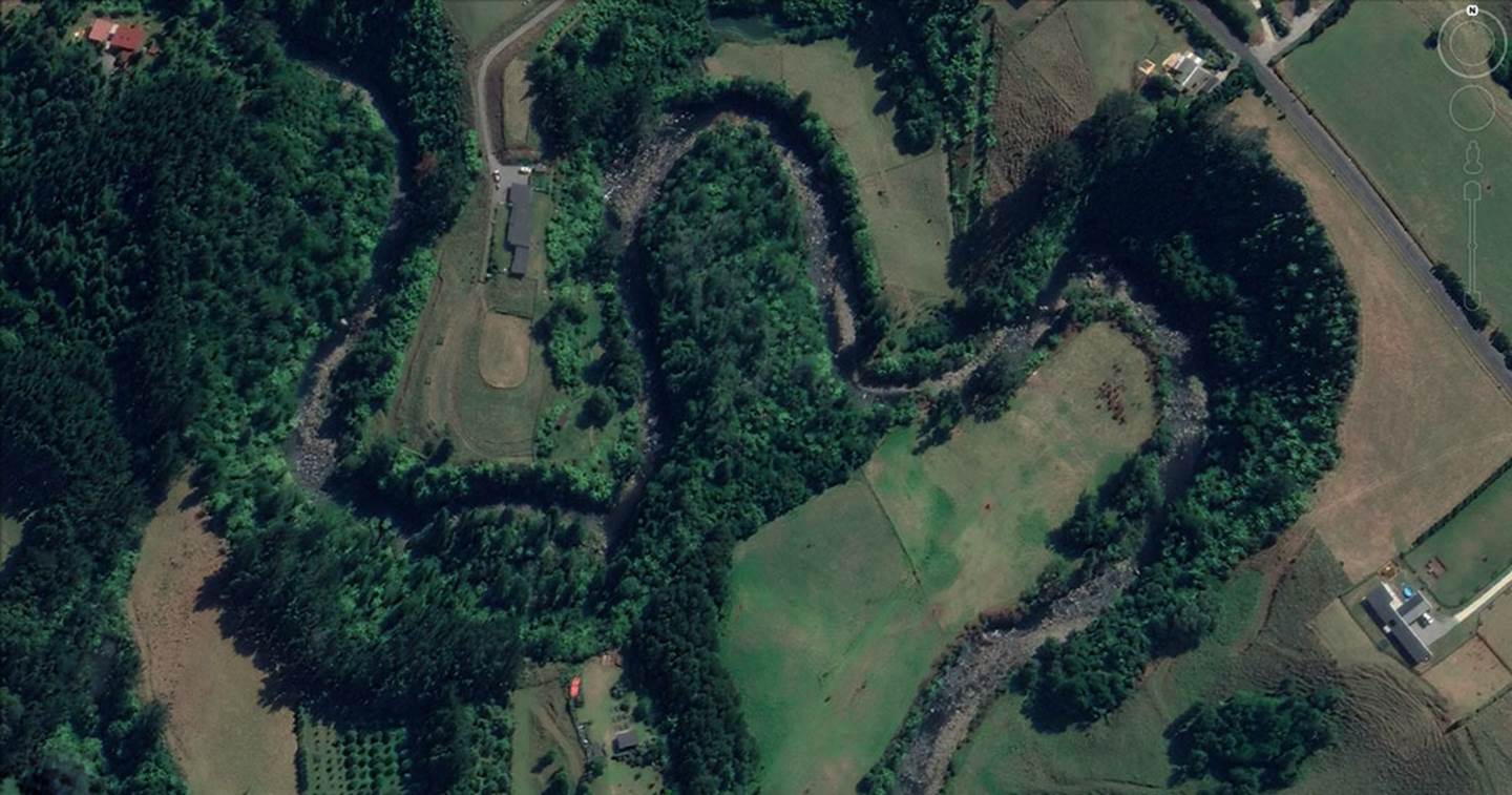
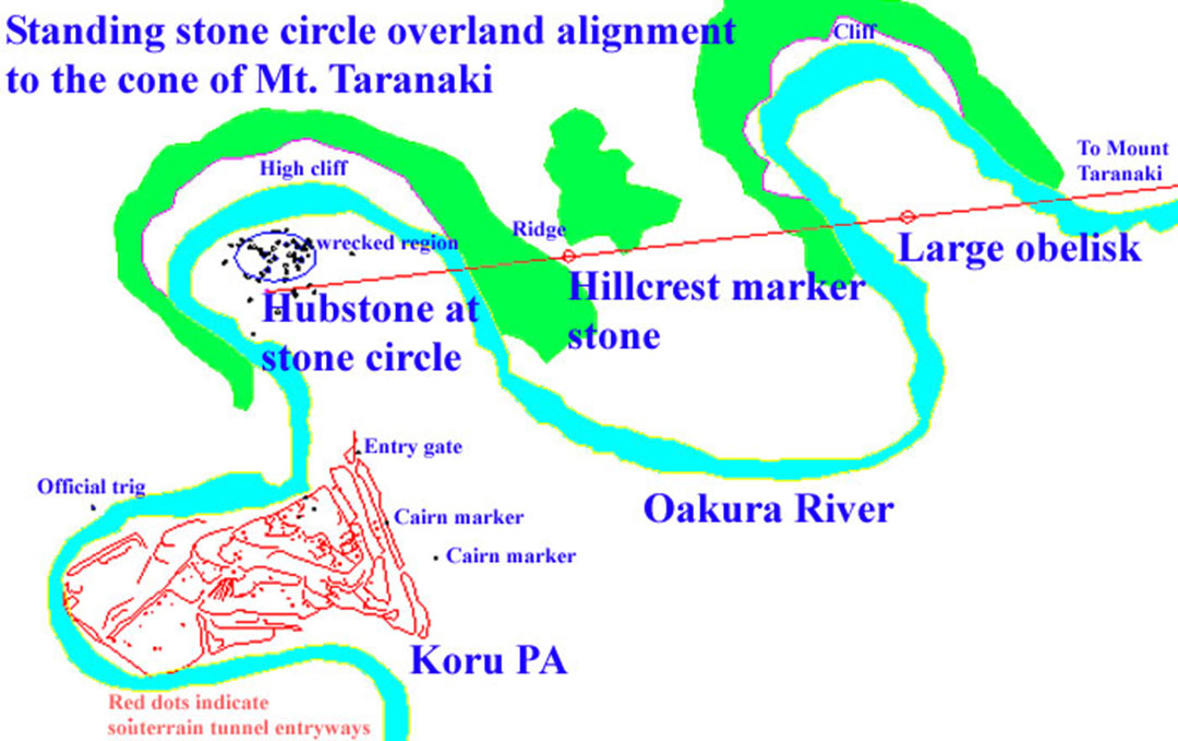
THE KORU PA STANDING STONE CIRCLE
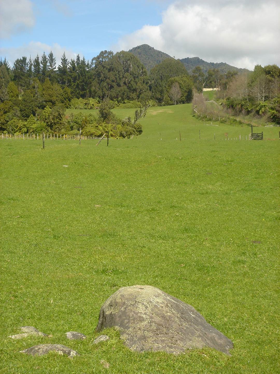
Another very significant location to the NNW of the mountain is Koru PA (the stone PA) at Kaitake, near the city of New Plymouth. It has its own standing stone circle and was obviously a school of learning at an ancient epoch, before the original inhabitants had to flee from the late arriving Polynesian-Melanesian warriors a few centuries ago.
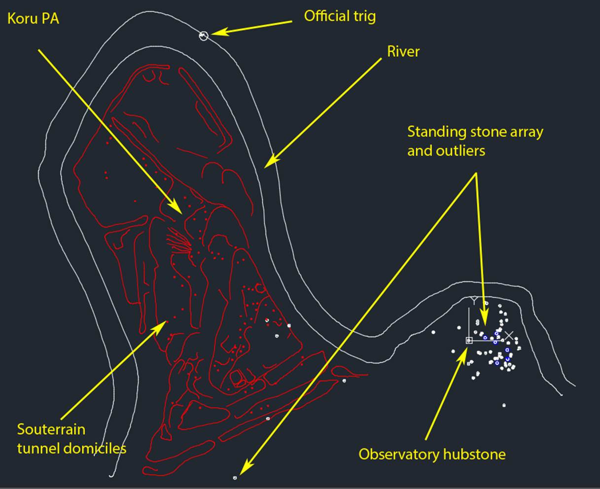
Koru PA sits within a river peninsula, where the river almost circumnavigates the entire site. The red dots are the entrances to underground domiciles, where people could live in relative comfort, out of the elements in all weathers. The white dots represent the positions of purpose-placed boulders for a standing stone array and each position was carefully selected to be at a coded distance and angle from the central hubstone. The blue encircled dots represent spots where the original markers have been disturbed.
By knowing the measurement standard used by ancient societies across several continents, as well as the 360-degree compass system, each outlier position will generate two numbers, one of distance and another of angle around from north. The numbers encoded relate to navigation and the equatorial circumference of the Earth, the lunar nutation cycle of 6804-days and the lunisolar calendar system. This, like other standing stone circles or arrays across the world, is a library of numbers essential to the establishment and maintenance of civilisation.
The standing stone array sits at a low aspect, with cliffs obscuring views on all but the eastern and southern sides. From this we know that the information encoded into the stone positions did not, to any large degree, relate to a panorama of distant targets other than trig peaks to the east and south. The positions were primarily for teaching initiates the special parcel of scientific numbers shared by the great civilisations of antiquity.
Koru PA, also called the stone PA, due to embankment tier walls having been lined with stone, sometimes to a height of 12 to 15-feet high. The standing stone array, with all the stones now lying recumbent, has high cliffs encircling much of it.
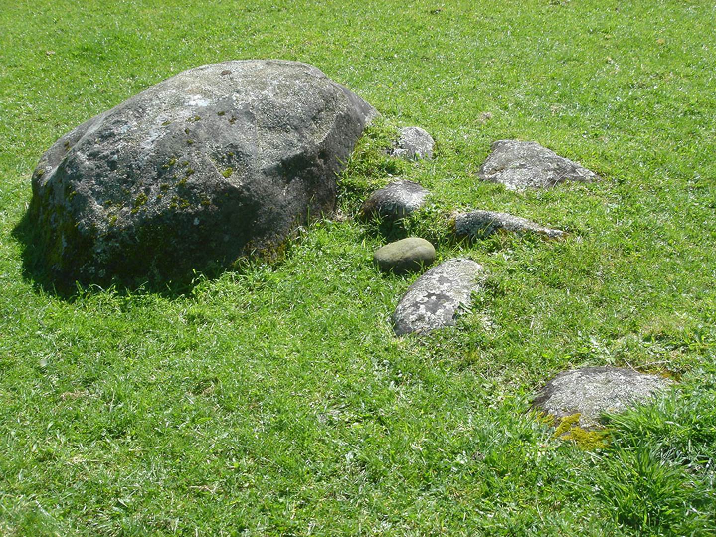
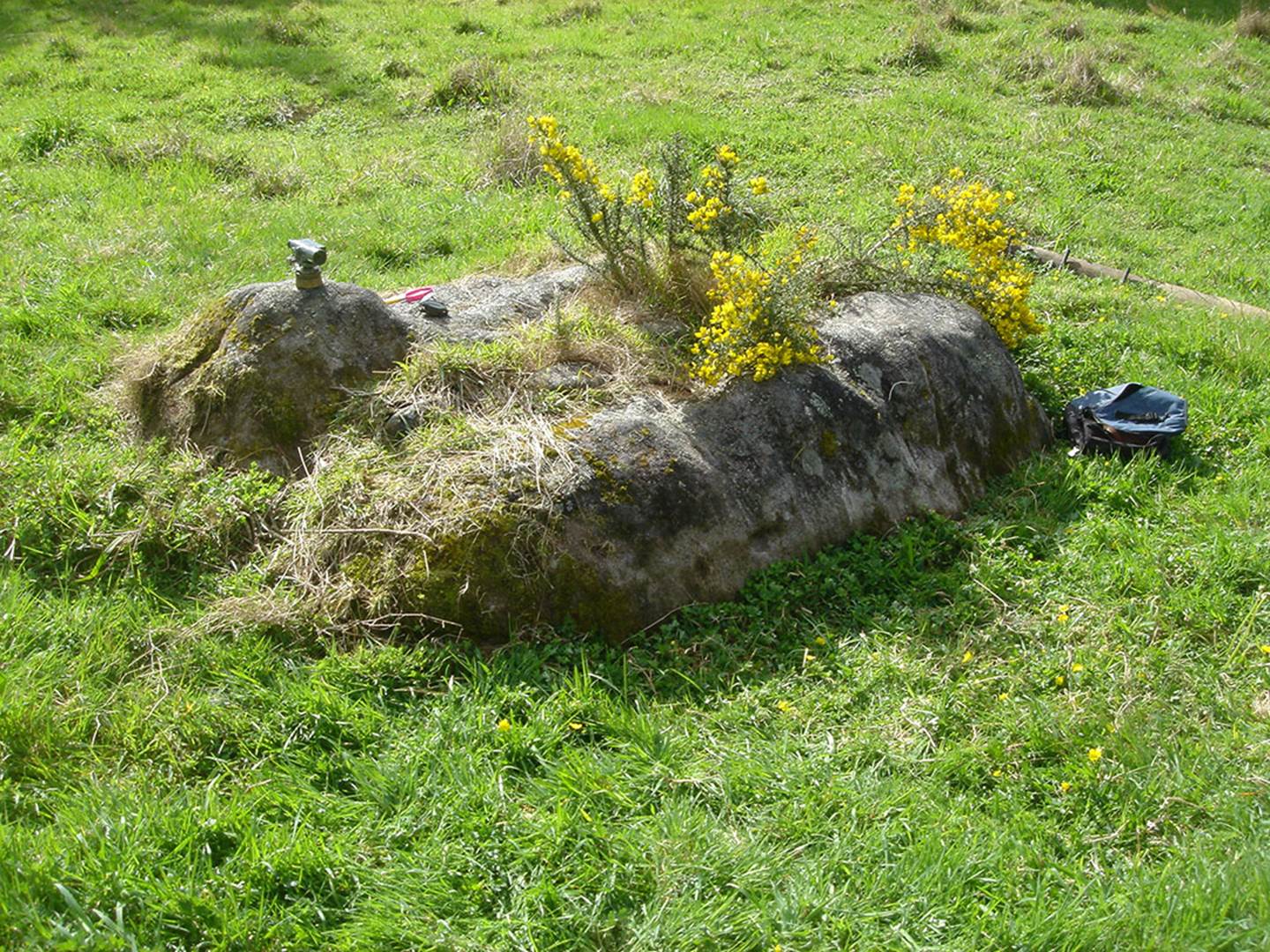
Here is the Koru PA hubstone, now lying recumbent after many centuries of abandonment. The smaller boulders to the right side were once chock-boulders, forming a supportive cradle in which the hubstone sat upright. From that position all outlier boulder markers sat away at specific distances and angles. Numbers generated by the measured distances or angles (under the ancient Sumerian 360-degree system) encoded scientific information about the equatorial size of the Earth, the lunar nutation cycle (18.613-years) or cyclic astronomy and the Sabbatical lunisolar calendar. The measurement standard used was the same as one would find at British, Continental European of Mediterranean standing stone circle sites dating to 3000 BC or more remote epochs.
It appears very strongly that the angle from the hubstone of Koru PA’s standing stone array to the high peak of Mount Taranaki was intended to encode 161.8034-degrees and relate, in enlarged numbers, to the PHI ratio of 1: 1.618034. This ratio was highly important throughout the great civilisations across several continents. The ratio of area contained within the 4 faces of the Great Pyramid, in relation to the area covered by the base = 1.618034 to 1. Many other examples concerning the ancient encoding of the PHI ratio could be cited. This line is marked by an alignment of boulders that extend out from Koru PA’s hubstone.
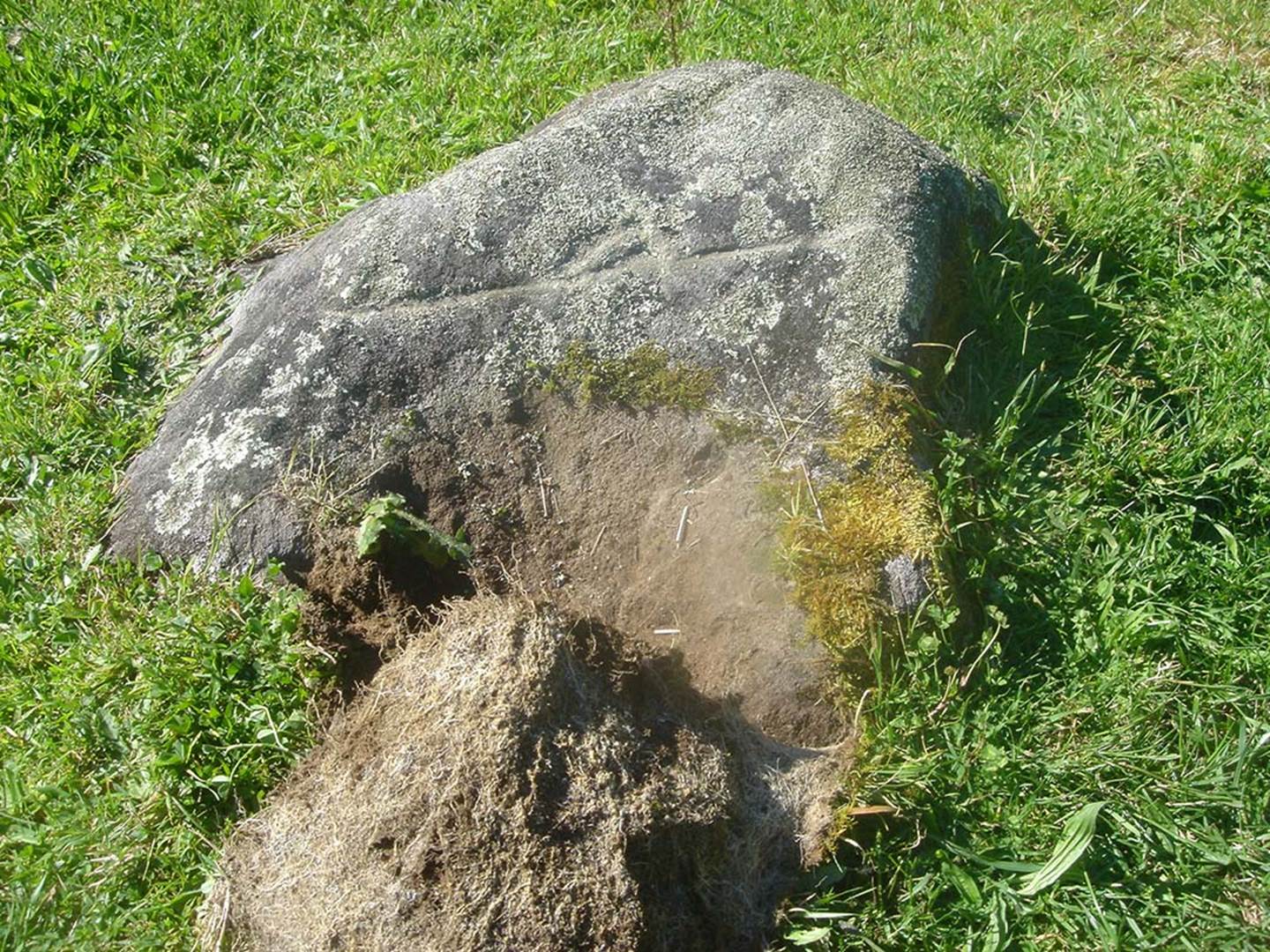
Lying out from the hubstone on the alignment running towards Mt Taranaki’s peak is this incised boulder. The horizontal line indicates the foothill range line and the protruding upwards triangular shape represents Mt Taranaki looming above the foothill range. From this boulder Mt Taranaki cannot be seen as it is obscured by a high cliff on the other side of the river. Nevertheless, when one goes to the top of the cliff on this alignment, there are yet more marker obelisks and a clear view to Mt Taranaki.
Once at the obelisk markers atop the river cliff, the view of Taranaki looming up above its foothills duplicates the incised boulder image in the valley floor. The incised outlier boulder of the standing stone circle sits on the alignment to the peak of Mt Taranaki, extending through yet other outlier marker-boulders on this 161.80-degree line marching towards the mountain.
This is the view towards the position of Mt Taranaki that one would get from the hubstone. Thus, the incised stone, situated in the valley floor 79.2-feet from the hubstone, told an observer what would be seen on that alignment at the top of the riverside cliff.
From these purpose-placed boulders atop the riverside cliff, Mt Taranaki, looming above its foothills comes into view. A couple of valleys further over is a large obelisk that sits on the 161.80-degree alignment, with Mt Taranaki seen through the tree line.
A tumbled obelisk on the river cliff alignment of boulders, extending towards the snow-capped peak of Mt Taranaki.
The 161.80-degree alignment further extends to this giant obelisk, fallen and broken in the field of a farmlet a couple of valleys to the SSE. From this low valley position obelisk Taranaki’s peak is seen to sit in a “V” between the declining edges of two hills.
LET’S LOOK AT SOME OF THE OBELISK/BOULDER MARKERS OF THE KORU PA STANDING STONE CIRCLE, AN ANCIENT WHAREWAANANGA.
The hubstone, now tumbled off its cradle, was fixed to several trigs, including Kaitake peak.
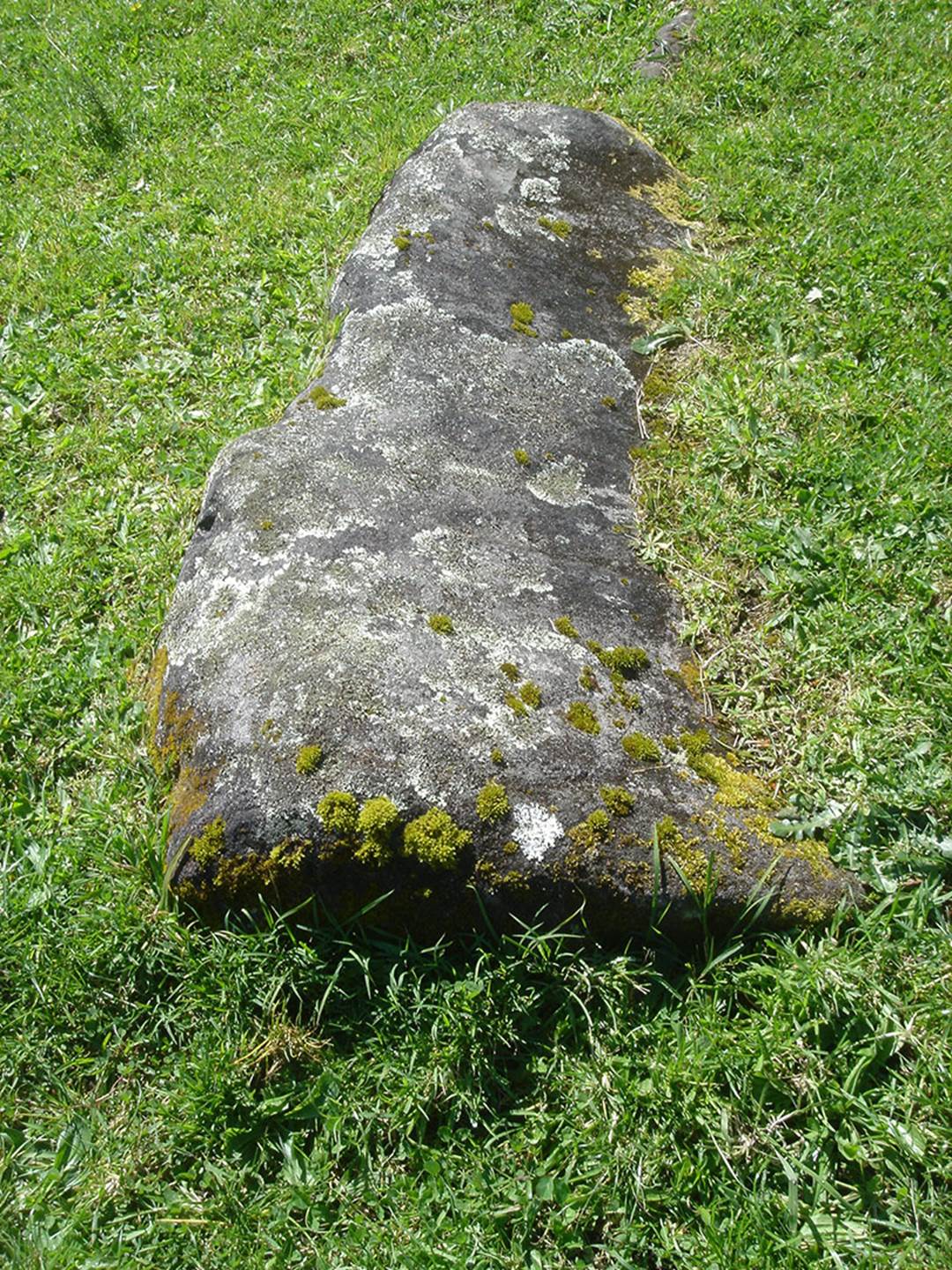
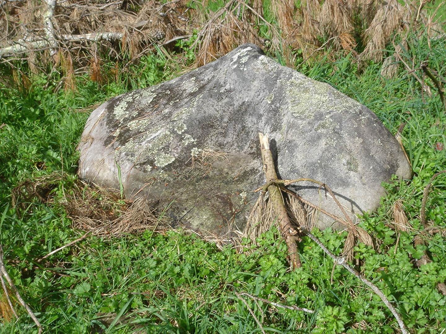
A large, sharks-fin shaped boulder lies recumbent and partially buried in the grass. It can, however, still divulge its code of position.
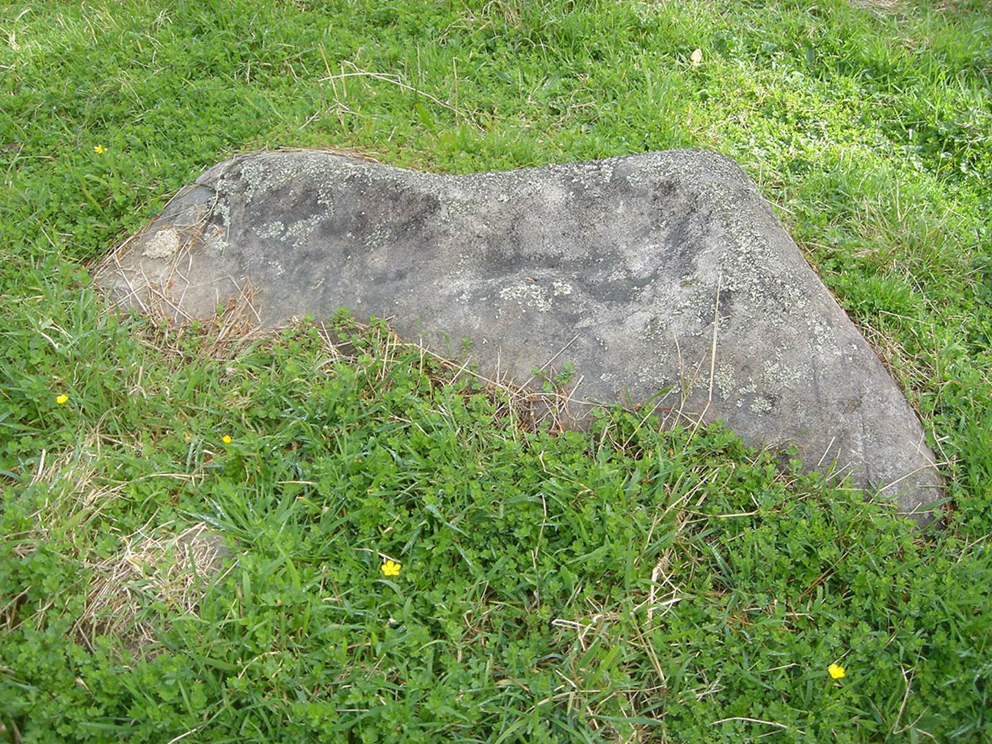
And yet another obelisk, fallen, but with the former base position fully identifiable and still very close to where it stood upright. Its code-of-position is still extractible.
Another sharks-fin shaped obelisk lying partially under a farm fence near the river.
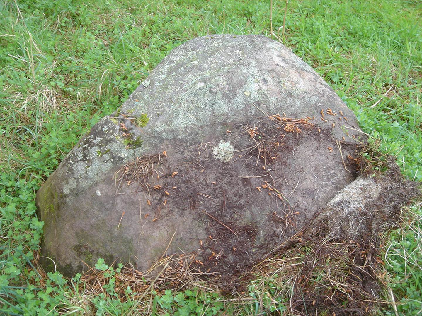
This large obelisk lies deep in the humus.
And so forth … many purpose place obelisks containing codes of position in their distances and angles away from the hubstone.
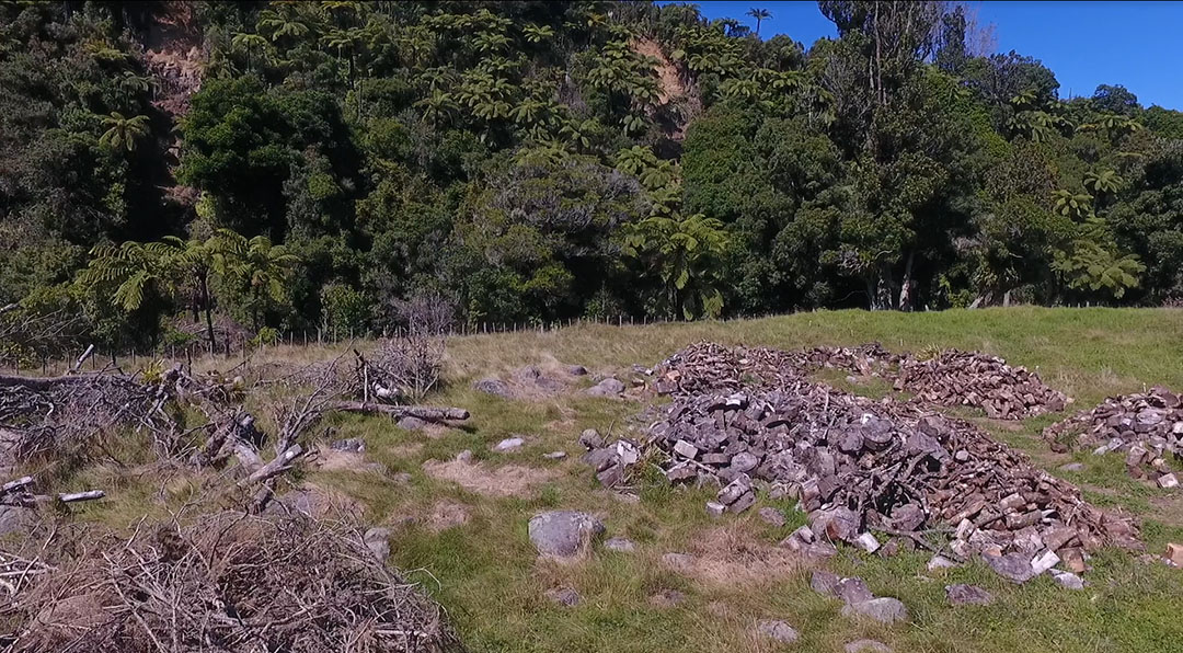
Unfortunately, at the time of this writing someone is conducting a firewood operation on the Koru PA standing stone circle site and many of the boulder-marker components are smothered in cut and uncut wood heaps. If wood-loading machines are used, the precisely, purpose-placed, ancient positions of the stone markers are in severe jeopardy of being erradicated, thus making future analysis related to codes-of-position impossible to decipher .
Such is the contempt our authorities have for New Zealand's long term, very significant archaeological sites and the irreplaceable history they contain. WHO issued a permit for this destructive activity?
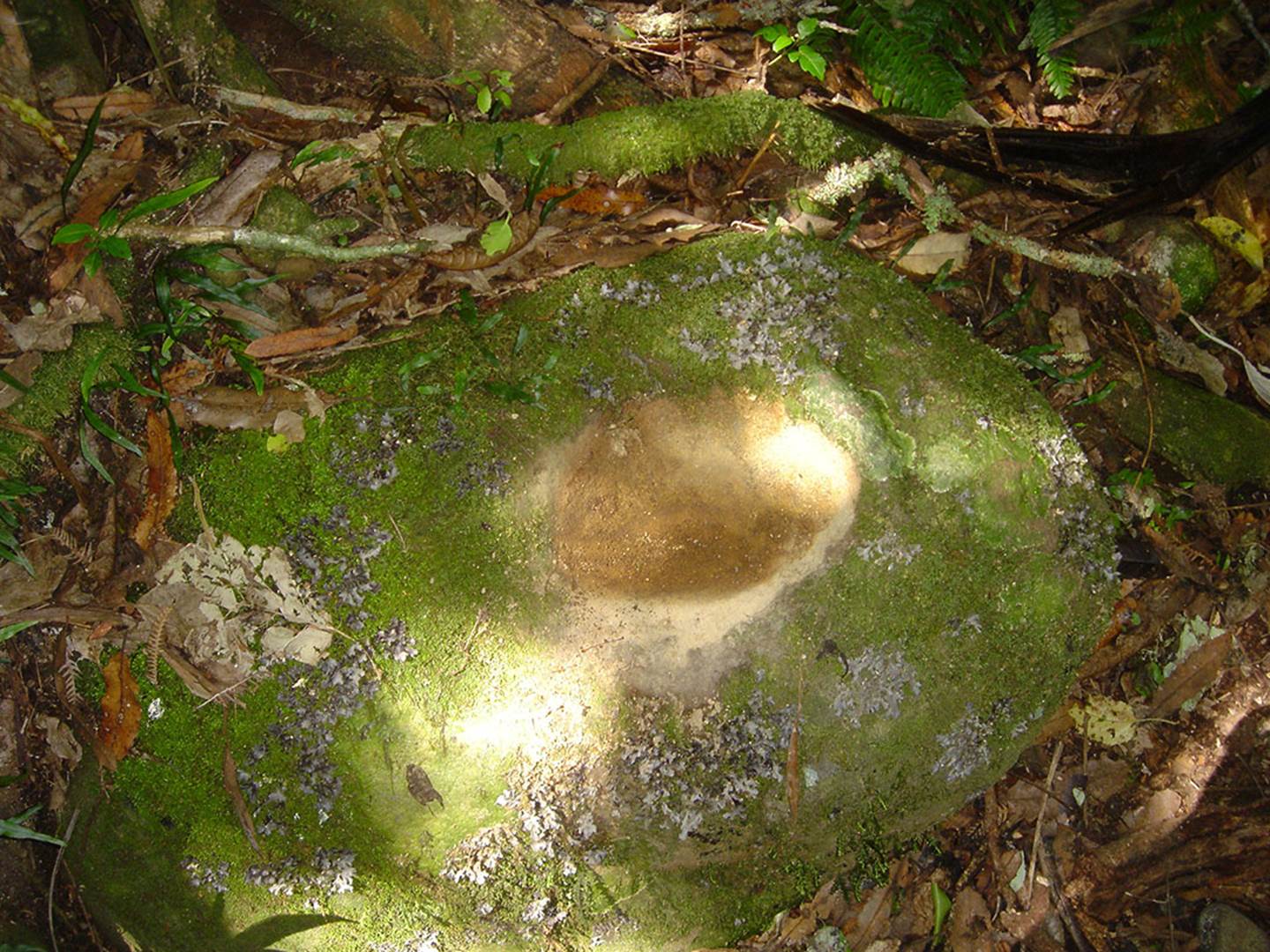
Also found at the site is this carved bullaun bowl. In ancient Ireland (going back to circa 3000 BC or before) these were used for ceremonial washing and the bullaun boulders also functioned as “blessing & cursing altars", a practice that continues in Ireland to this day at the holy wells. Ancient bullaun bowls are found all over New Zealand, mainly beside rivers and water courses.
Ancient religious practices of Ireland, using bullaun bowls, a ritual practice that extended across Europe generally, became frowned upon by the latter coming Christian church, which did all in its power to disallow the bullaun related rituals. However, the use of ceremonial washings for health and deliverance from illnesses, blessing and cursing, was so engrained in the populace that the church had to finally adopt the bullauns as baptismal fonts.
Ancient bullaun stones are sometimes found at the entryways of old Catholic churches as vessels containing holy water. Upon entry or exit of the church, believers dip their fingers into the holy water, then perform the sign-of-the-cross.
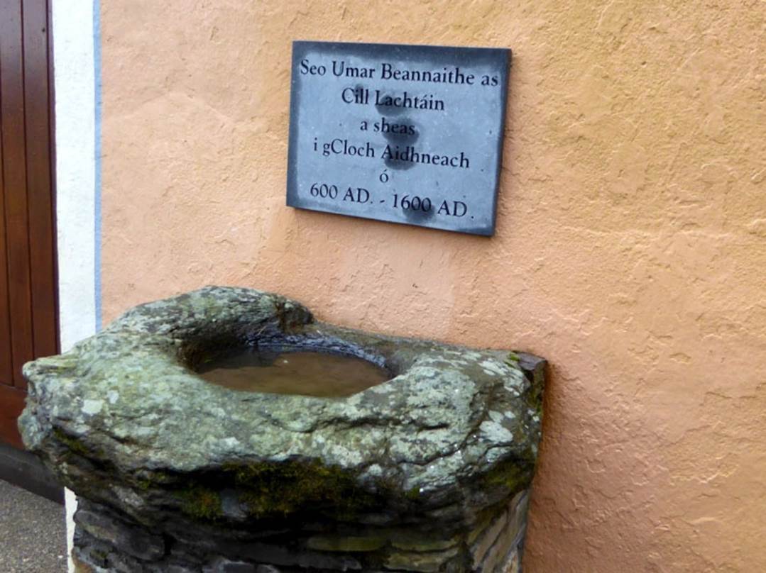
This example, outside the door of the church at Cill Lachtáin, Co Cork, Ireland seems to have been mounted to perform as a holy water stoup: the plaque reads ” . . . This blessed font of Cill Lachtáin was standing in Cloch Aidhneach from 600AD to 1600AD . . . “ Others resemble fonts and are similarly associated with places of worship. See: https://roaringwaterjournal.com/2019/12/01/the-enigmatic-bullaun/
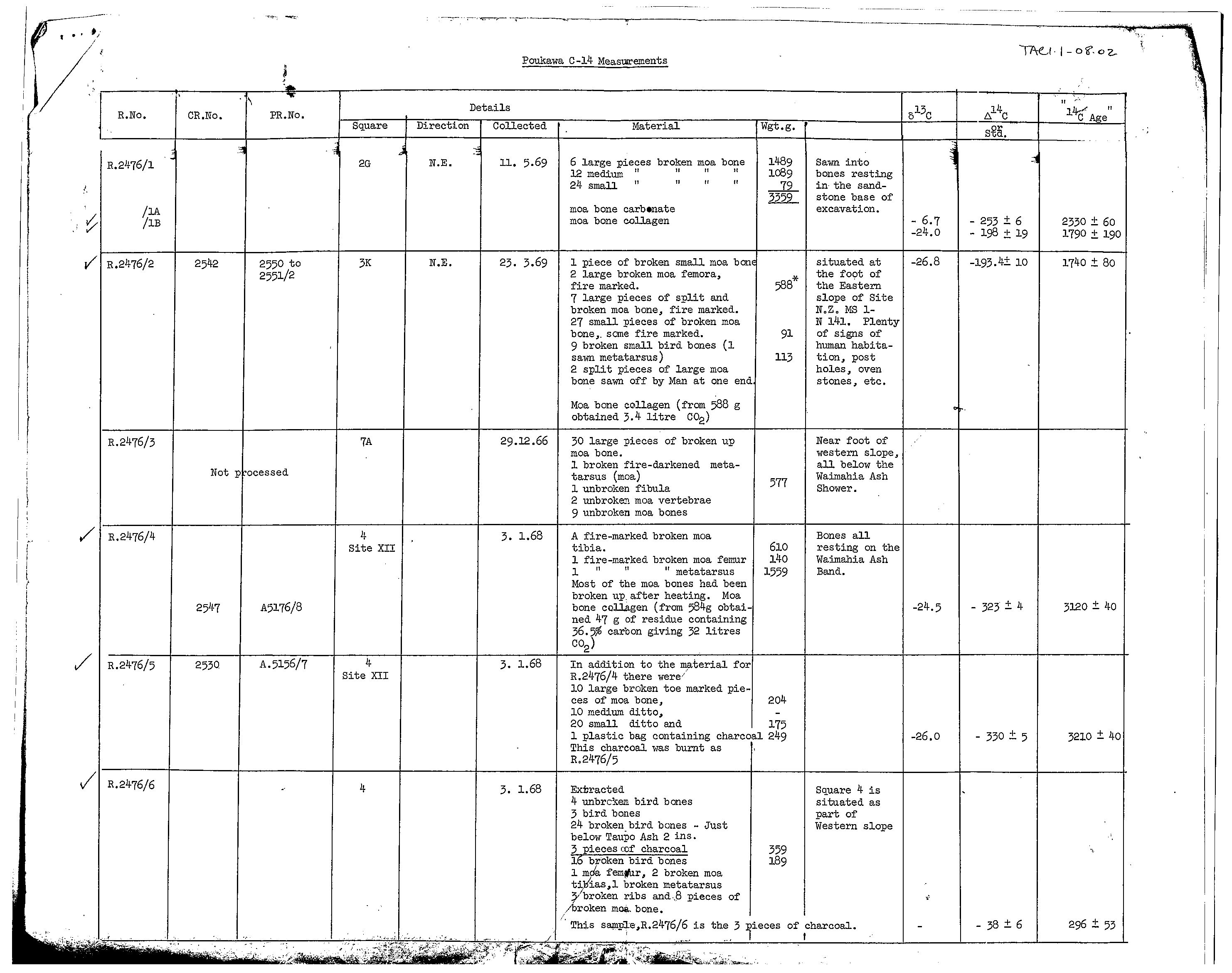
Suffice it to say that New Zealand had an ancient megalithic culture that paralleled those of Britain, Continental Europe and the mediterranean of 5000-years ago. We have carbon-dating (C14) results showing human occupation at Poukawa, Hawkes Bay, NZ at 7170-years +/- 70-years before 1950. We also have a C14 result for Oturehua in New Zealand’s South Island for 9542-years before 1950.
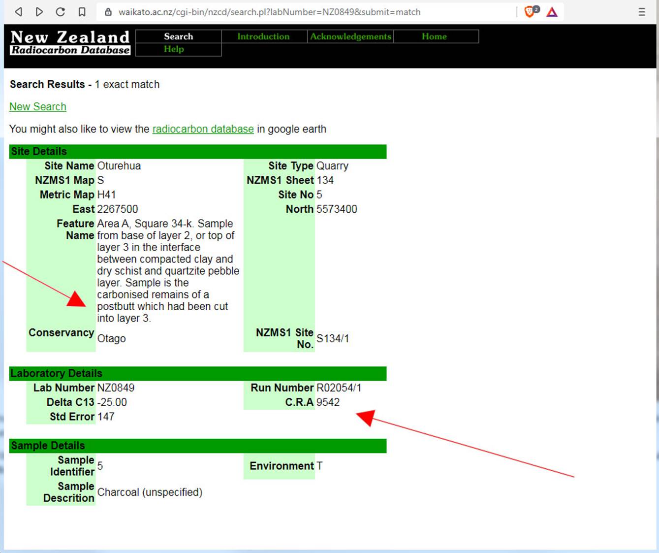
Although the mainstream NZ archaeologists, under the new reporting conventions, are not allowed to find evidence of anyone inhabiting New Zealand prior to Maori-Polynesians arriving in about 1300 AD, sometimes suppressed and censored results manage to slip-in under the radar. Someone installed a post at Oturehua 9542-years before 1950. This is but one of many C14 results we now have in our possession showing very ancient habitation of New Zealand.
To see some undisputable, 50-year old, C14 Radio Carbon Dating results, issued by the New Zealand Department of Scientific & Industrial Research (The Rafter Lab), of very ancient human occupation in the Poukawa Valley of New Zealand, go to the 3 links below and magnify the C14 sample figures for clear reading.
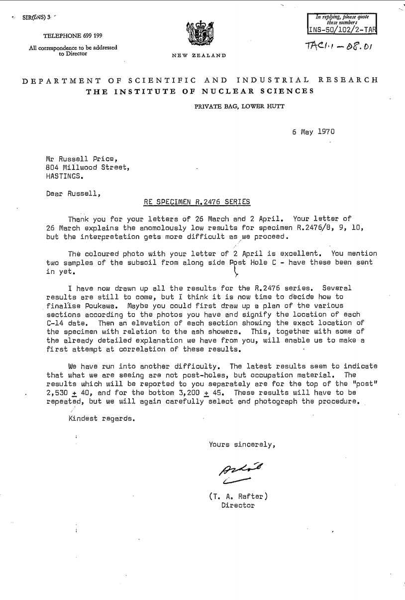
Poukawa Carbon Dating Results 1
Poukawa Carbon Dating Results 2
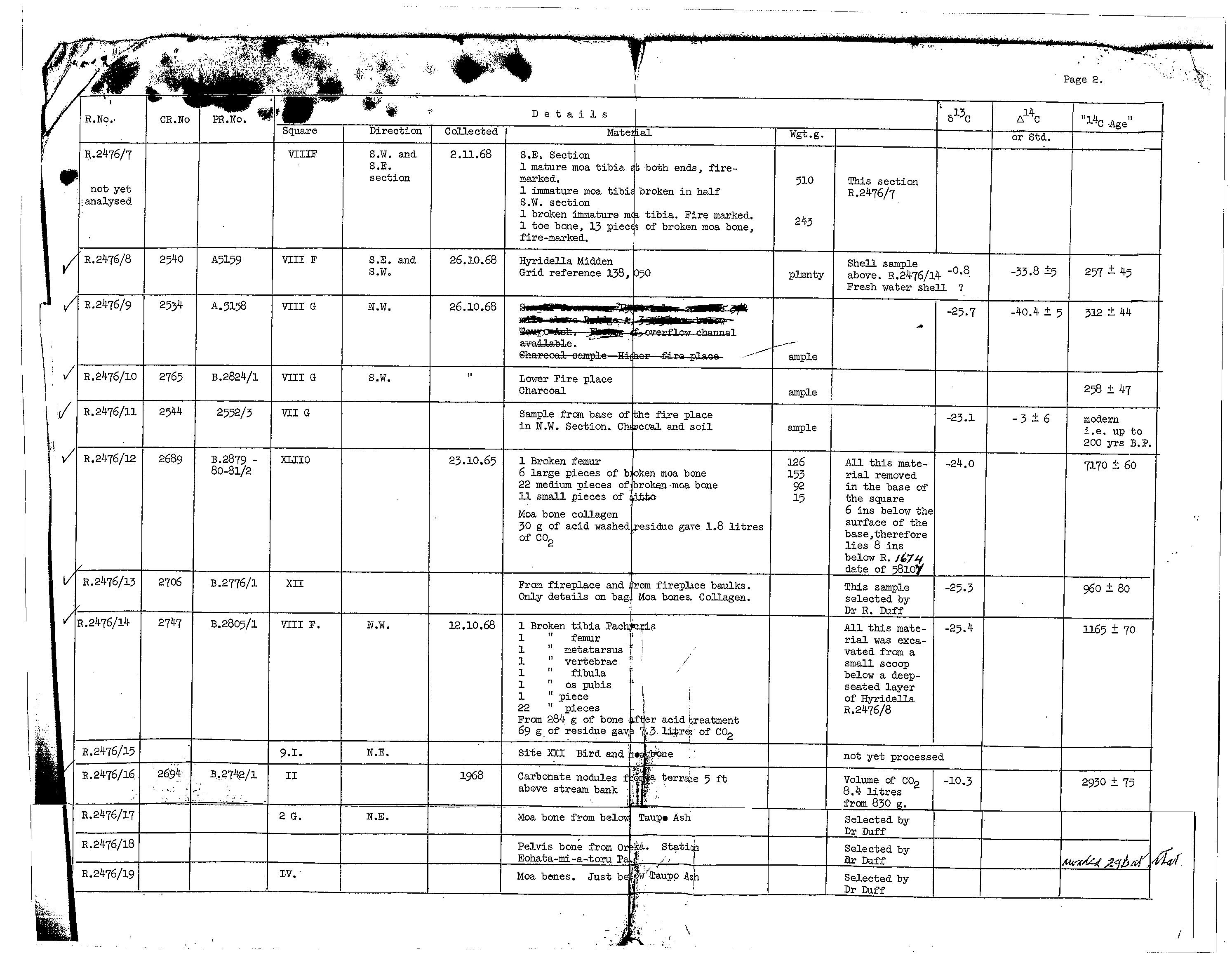
Poukawa Carbon Dating Results 3
New Zealand is a very old country that has been continuously occupied for at least the last 10,000 (ten thousand) years. However, our general-rabble of social-engineers, social-achaeologists, social-anthropologists and social-historians, all working from the same play-book, are strangely silent about that elephant-in-the-room.
Martin Doutré, Auckland, New Zealand, 25/06/2021©.