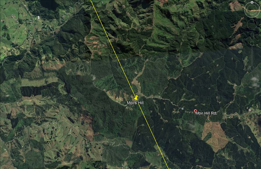

The next component of the alignment is Moir Hill, Warkworth.
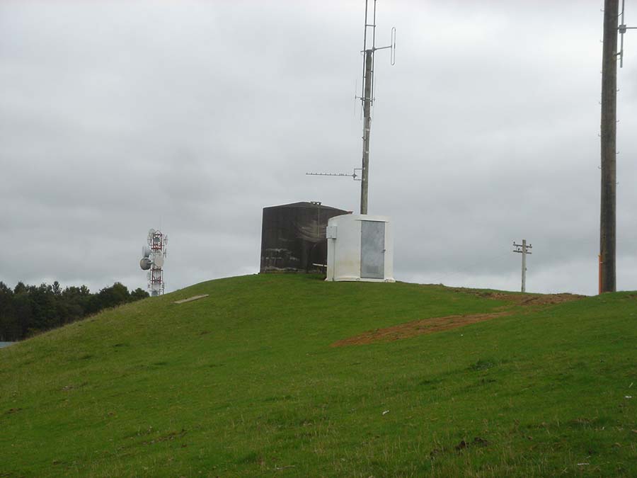
Yet again, the elevation of this mound hump, offering excellent views through 360-degrees, made it very suitable as a site for modern day communication’s equipment. It sits close to a modern trig bearing the geodetic survey mark 1343.
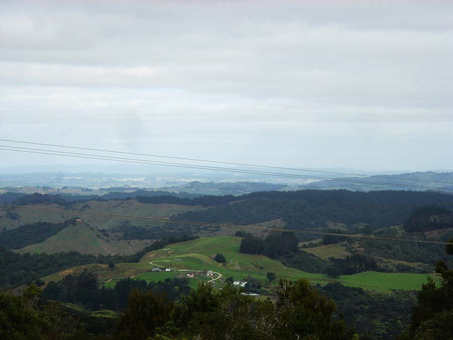
Looking SSW towards Orewa-Silverdale where a dynamic ancient trig was discovered by road-workers in 1972.
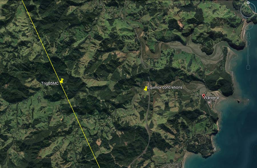
En-route to Orewa-Silverdale the line crosses over the position of geodetic trig B5MC in the high hill country near Puhoi township.
To the east of that trig, in the low estuary region of Waiwera is an ancient solar observatory made up of huge concretion boulders. An observer at the boulders, looking east, views the declining hill on the south side of the Waiwera township estuary and behind it, the declining end of the Wenderholm cliffs on the north side, together forming a “V” in the coastal landscape. On the day of the equinox the sun is seen to rise in the “V”, providing a precise fix on which day constitutes the equinox.
The position where the concretions occur is on a red clay hill and concretions can only form in sea sediments, thus showing the massive round boulders were moved by human hands to that precise spot as markers for an equinox solar observatory.
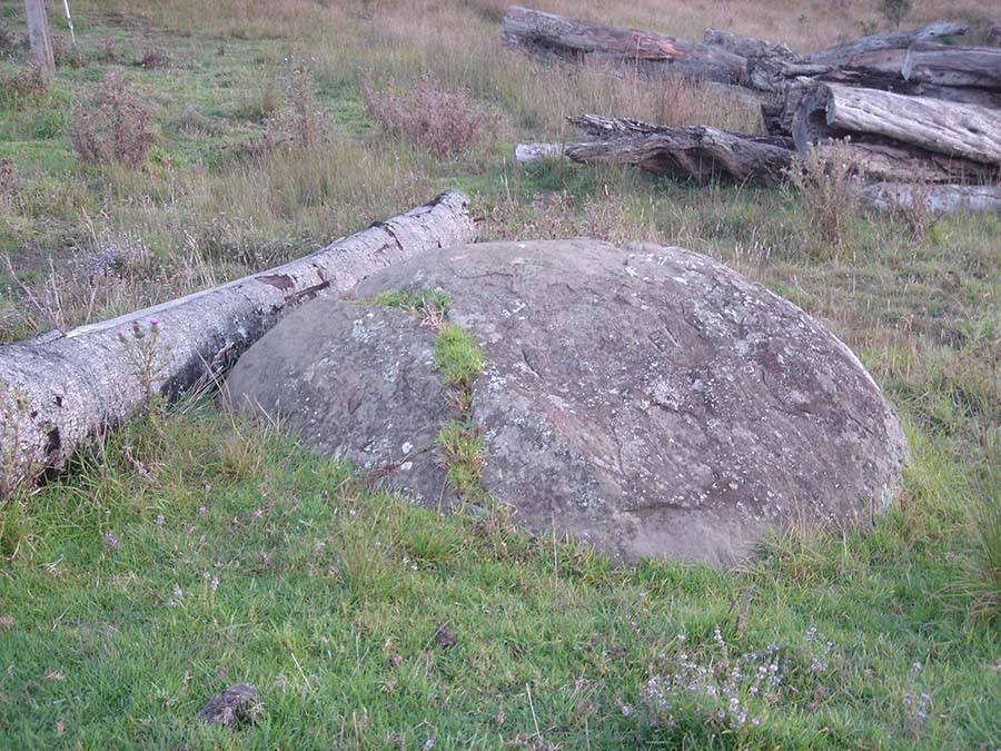
One of the double set of concretions that mark the equinox sunrise at the coastal estuary entrance of Waiwera township. The solar observatory also provided an accurate fix on the equinox sunset into a dip on a range to the west.
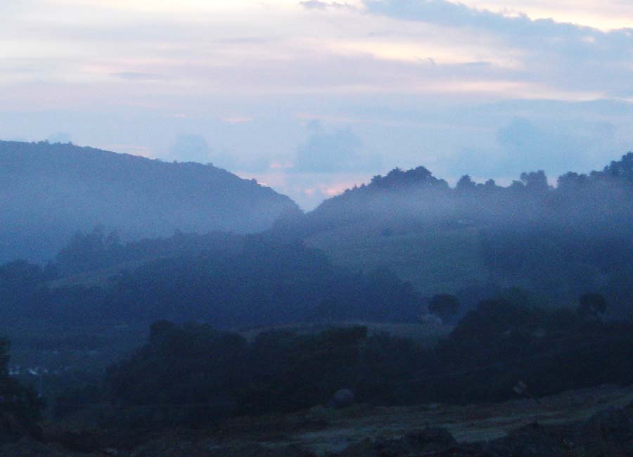
A magnified view of the Waiwera headlands “V”, where the sun rises on the equinox from the observer’s position at the concretion boulder, solar observatory. On this occasion morning cloud obscured the sunrise view somewhat, but the sun-glow shone through.
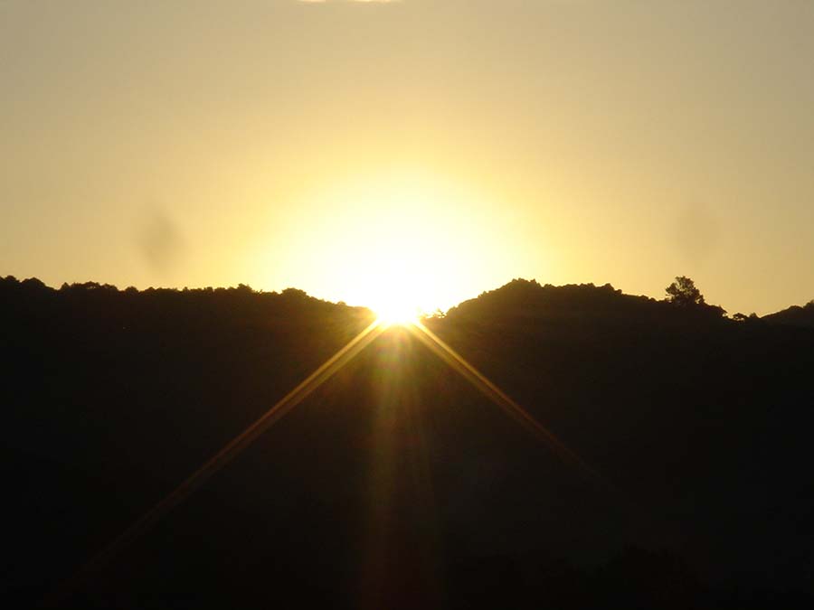
From the Waiwera solar observatory the equinoctial sun settles into a prominent “V” in the western hill country, giving an accurate fix on just which day constitutes the equinox.
Likewise, the concretion’s position represented a very important trig, orienting onto Moehau mountain, one of the most venerated mountains of New Zealand.
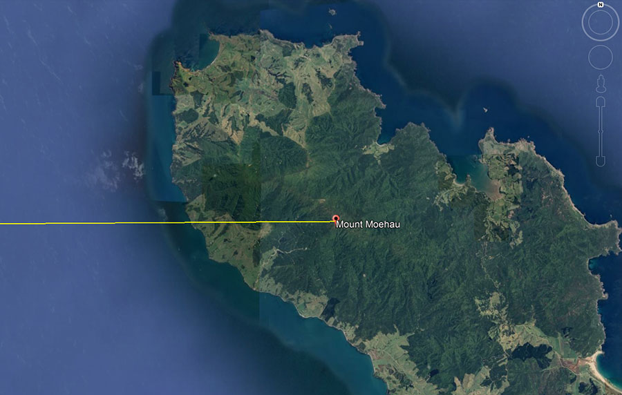
From the Waiwera concretions position, Moehau Mountain looms up 40-miles away on the Coromandel peninsula and can be faintly seen in clear weather. Its peak sits due east of the concretions to within .03 of a degree of accuracy.
In the latter days of hostility when the Maori warriors were actively subjugating the more ancient, long-term inhabitants, many escaped to the sanctuary of the steep, inhospitable terrain of the Moehau Range and hid out there for generations. In high locations such as this around New Zealand they became known as the “children of the mist”, not unlike the Chachapoya or Cloud People of Peru, hiding out from the predations of their Inca conquerors. Like the former inhabitants of New Zealand the Cloud People of Peru had Caucasoid-European physiology, as their preserved mummies attest, a fact conveniently muted as an “unmentionable” in academic circles.
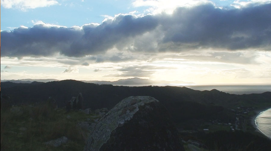
This picture was taken on Tahanga Hill, Opito Bay, Coromandel Peninsula at the time of the winter solstice. In the foreground is the, still standing in situ, hubstone for the site and behind it is Mount Moehau. The winter solstice sun descended down and landed squarely on the peak position of Mount Moehau, giving a precise fix on the winter solstice calendar date.
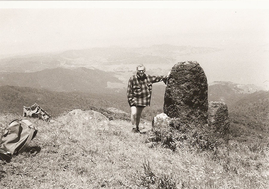
A photo sent to us by a tramper who had made the difficult climb to one of the peaks of Moehau Mountain. An ancient obelisk, supported by smaller boulders stands on this peak facing the Thames estuary.
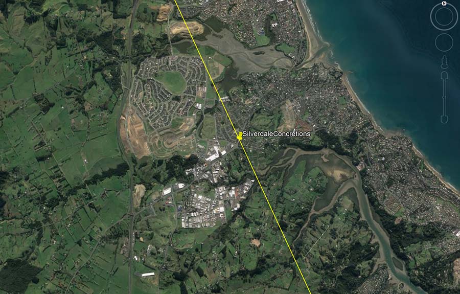
In 1972 it was decided to remove an obstructive hill that blocked the fluid flow of traffic going through Silverdale and Orewa townships, as well as down the long Whangaparoa Peninsula, to make a major crossroads intersection. As the large Euclid motor-scraper made the first cut into the top of the hill the blade struck the first of a cluster of large concretion boulders, one of which was about 12-feet in diameter. After that bulldozers had to cut around the cluster-group to expose, then remove the grouping of boulders.
The find caused much consternation and head-scratching at the time, as concretion boulders could not have formed at that location atop a clay hill. They must grow slowly over millions of years in lime and sand-rich sea sediments and when found on land are in the same papa-type sea sedimentary incubation material that formed them.
Clary Neville, superintendent of works, promised reporters and the public that his soil-tech engineers would provide a report, but one was never forthcoming, probably because no-one could account for how the concretion stack could have occurred there naturally and without ancient human intervention.
A further problem was that the cluster sat just below the surface of the hill crown, meaning that the once exposed and highly visible boulder cairn arrangement must have been abandoned thousands of years ago for detritus to build up sufficiently to cover them. Inasmuch as human hands were required to move the boulders to the top of the hill, and that there weren't supposed to be any people in New Zealand before about 1250 AD, it was obviously considered politically-expedient to side-step the bothersome issue altogether.
The original 12 concretions now lie scattered or smashed at different locations around Auckland City. The largest ones are still near the crossroad’s intersection at Silverdale, but another seven smaller ones were “stolen” in the night by the Auckland City Council for use as display items at the Auckland domain Park entrance or the Geology School at Auckland University. Of the seven taken into the CBU of Auckland City, two are inscribed with arrows or cross-hatching design work made thousands of years ago by human hands, an inconvenient fact never mentioned by mainstream archaeologists.
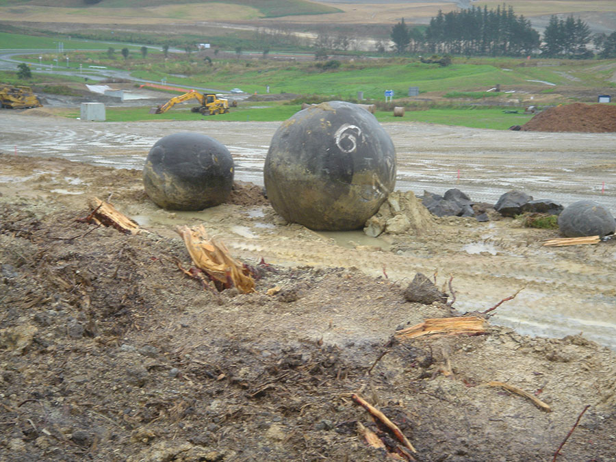
For years the huge concretions (one about 12-feet in diameter) sat adjacent to the new crossroads where the 70-feet high hill they formerly sat atop once stood. In 2009 land developers moved in with excavation equipment to build a medical centre and the boulders were unceremoniously shunted aside, causing some of them to be smashed. There was a public outcry and Rodney County Council had to give assurances that the surviving boulders (which are actually historical artefacts & archaeological treasures) be henceforth treated with all due care and preserved for posterity.
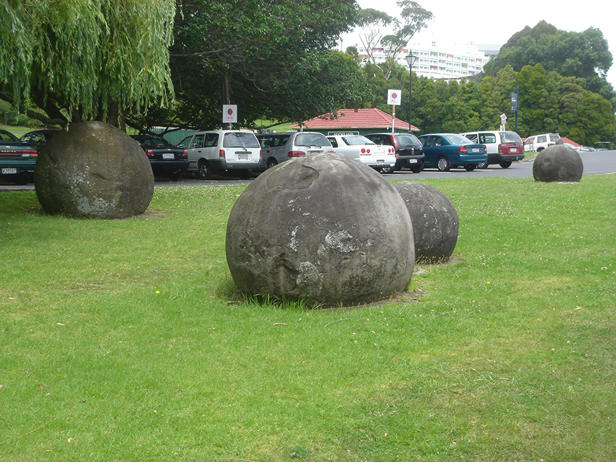
Here are four of the moderately large concretions “stolen” in 1972 by ACC for their Domain Park display. To the credit of the ACC the concretions have been well cared for and are in a fine state of preservation almost half a century later.
The one at the top right of the picture is covered with cross-hatching geometric designs and an elongated arrow. Two more concretions, one of which has a layered spiral design inscribed into it, were put on display nearby at Auckland University.
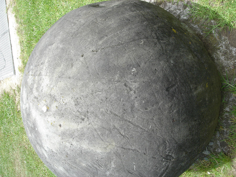
Very much in the vein of ancient British cross-hatching designs, incised lines (now faint) and geometric patterns are found all over this concretion boulder. It possibly represented a kind of “gypsy-map” for ancient wayfarers stopping to rest at the ancient Silverdale trig on the waymark trail. Across the top of the boulder can be seen an elongated arrow.
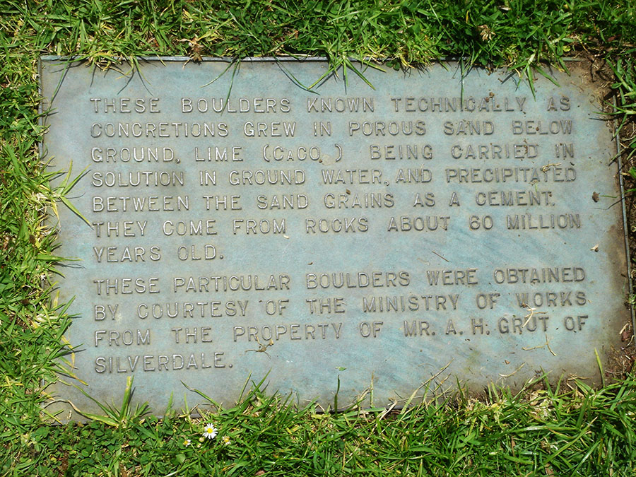
A brass plaque (since stolen) beside the concretion boulders at the Stanley Street entrance to the Auckland Domain Park.
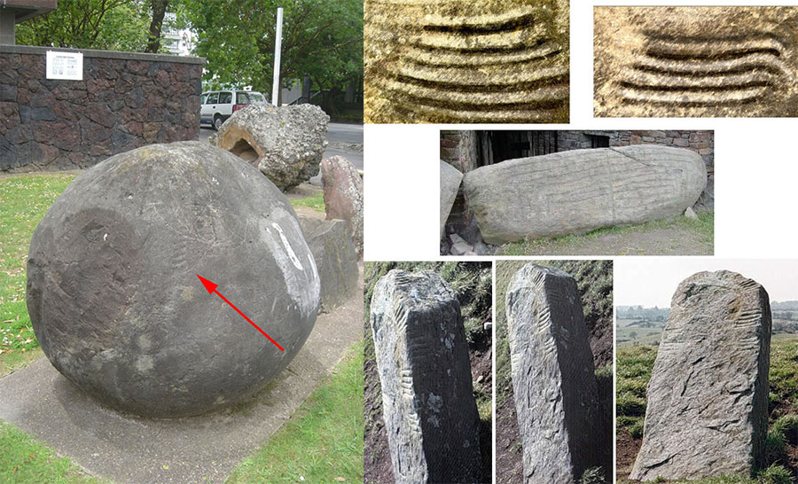
To the left is one of the Silverdale boulders formerly on display at Auckland University (until a new building appropriated the site). The fate of the boulder is now unknown. It is seen to have a layered spiral design on its side. This design has been found on other ancient trig boulders around New Zealand or concretions of the Silverdale cluster set. To the right top is seen the layered spiral (enhanced) pattern found on an anciently inscribed, basalt trig-obelisk at Bombay, Pukekohe district, South Auckland alongside a second layered spiral from another of the Silverdale concretions. To the centre right the same design is seen on the boulder at the east gate of Knowth, County Meath, Ireland and dating to 3150 BC. Below is seen an ancient British Ogham boulder bearing the same design. The design is also found on the rear side of the Omapere obelisk, Hokianga, New Zealand.
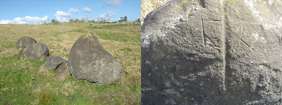
A former concretion, field trig or secondary surveying station that sat 1.17-miles due west of the 12-component cluster of boulders atop the Silverdale hill. One of the field trig boulders displayed the geometry seen above in the picture to the right and seems to infer various surveying triangulations onto local targets. The cairn trig sat in full view of Chin Hill (at 18-degrees azimuth) where a massive, ancient excavation was done as a very visible, surveying outer marker that could be seen from distant, high volcanic cones of the Auckland Isthmus.
This highly important field trig, composed of concretions, has now been smashed to smithereens by excavating equipment building a new subdivision. Our dumbed-down, PC archaeologists did nothing to preserve this important history.
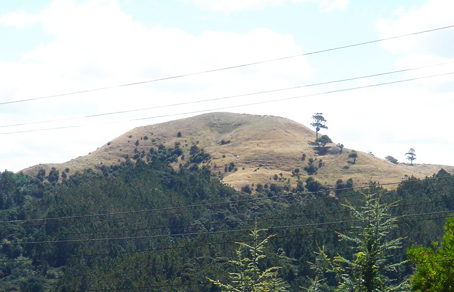
In the upper, south-facing side of Chin Hill is an ancient, very symmetrical excavation that can be seen for many miles. No colonial roads have ever led to the excavation and no modern equipment was ever used to remove the huge quantities of soil to form the “V” configuration. The excavation serves no farming function and has definitely been hand dug. As the sun moves through the day the cleft can become ever-more apparent and visible from far-flung locations.
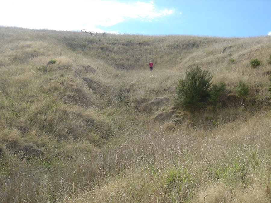
The Chin Hill shadow cleft, surveying outer marker, viewable from the terraced volcanic cones of the Auckland Isthmus, such as Mount Wellington (Maungarei … meaning the watchful mountain), 24-miles away to the SSE. The rear, north facing side of Chin Hill once had a similar excavation but that one slipped and lies distorted nowadays. That opposite-side, now eroded face would have serviced surveying fixes from locations further north.