THE ANCIENT STANDING STONE SURVEYING TRIG AT OPITO BAY, COROMANDEL, NZ.
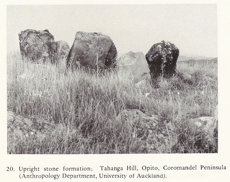
Monograph no. 10 of the New Zealand Archaeological Association, published 1979. Supplied from the archives of researcher, Gary Cook.
According to a learned Maori elder who has memorised the oral traditions of his iwi, the forebears to his people first arrived in New Zealand in the year 700 AD from India. Upon finding these shores, this branch of Ngati-kuri ancestors encountered a long-term resident population who were preoccupied with erecting stone markers on hills all across the country. The newcomers thus named the long established residents, "the surveyors".
Their surviving ancient handiwork can be anything from solitary obelisk boulders, smaller standing stone arrangements, stone-piled cairns, large earthen mound humps to sighting-pits or cliff-cut notches, etc. Many of these structures are on high hills or range crests, while others are in valleys. Each has a good view onto at least one or many horizon targets and each served an important surveying, astronomical or navigational function for the ancient society that erected it.
Some markers served a calendar-related function as solar observatories and still work perfectly. They were used to determine the exact days for the solstices or equinoxes and keeping the calendars running true. Yet others were primarily or solely for land-mapping over vast distances and were made up of a centre hubstone and circuits of satellite boulders that stood off from the central hub. In such cases, the hubstone would invariably orientate accurately onto a horizon target that provided a fix for true North, South, East or West. The far distant outer marker targets would be the highest mountain peaks or hill crowns in the region, at least one of which would provide the essential, primary degree angle by which all other degree angles could be precisely read through 360-degrees of vista.
The ancient surveyors had brought very profound mathematical knowledge with them from their lands of origin. They possessed highly refined measurement standards and shared an assortment of "cubits", "reeds" or "feet" rules with their many cousin nations. Measurements were standardised amongst the great civilisations and were all founded upon the selfsame inch.
At standing stone circles sites the ancient savants encoded their sciences by numbers, based upon a stone marker set at a measurable distance out from a hubstone and at a coded angle around from North. Both the distance and angle out from the hub would generate special factorable numbers related to cyclic astronomy, the lunisolar calendar, the equatorial size of the earth or systems of navigation and positional-plotting for safe traversals of the world's oceans.
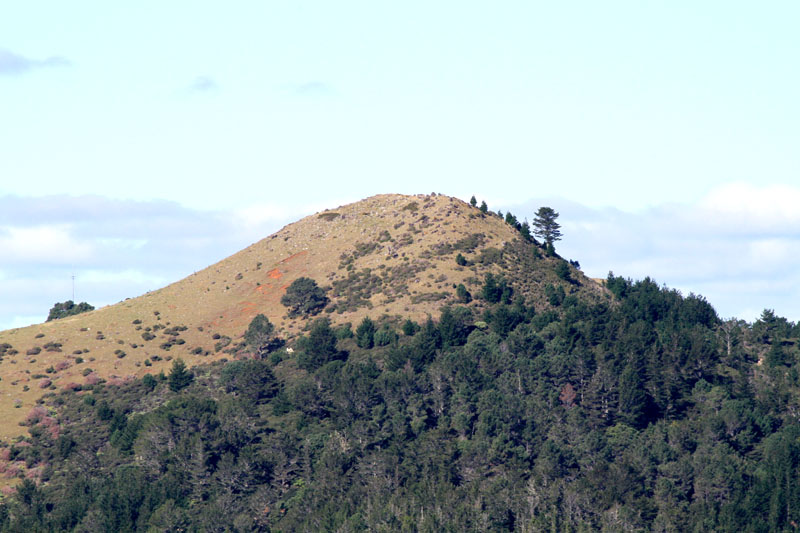
Tahanga Hill at Opito Bay was an ancient, very important resource for extremely hard basalt stone used in the fabrication of high quality adzes. Photo by Russell Ireland.
Opito Bay archaeologist, Brenda Sewell, writes:
'The top of the hill is bounded by a stone wall on its northern side and has been recorded as a pa site. On most of the slopes of the mountain are working floors where basalt rocks have been removed to be made into adzes, the finishing of which took place on the beach or dunes alongside the beach.' (Email to the author, 10/5/12).
'Adzes and other stone tools, originating at Tahanga Hill, were distributed throughout northern New Zealand, where they are found in some of the country's earliest known archaeological sites'.
Loose boulders and fragments, still observed to be lying on the slopes were, undoubtedly, anciently quarried from the hill and destined to become much-sought-after adzes, but later events (invasion-warfare-conquest) disrupted the enterprise and brought it to a halt.
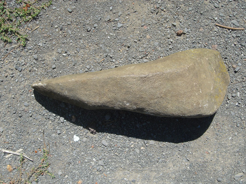
An unfinished adze fashioned from the high quality hardstone of Tahanga Hill.
Tahanga Hill is mentioned in Maori oral traditions as being associated with "Poutini", the foremost worker of stone (greenstone). A Historic Places Trust article says the following in relation to Tahanga Hill:
Tahanga's significance as a stone source to Maori can be seen in its inclusion in an oral tale which describes how Poutini, a guardian taniwha protecting the mauri or spiritual essence of greenstone, lit a fire on the beach before traveling on to other locations of value for their stone products. The account effectively provides a map of stone resources in New Zealand, and has been described as the country's first 'geological survey'.
Oral tradition references to Poutini (also known as the bright binary and navigational star Procyon in Canis Minor) are several and varied, but a Dominion Museum article devoted to Nature Myths gives the following account:
'One quaint old folk lore repository of Matatua district told me that Poutini the origin of greenstone is one and the same as Poutini the star. His people are the greenstone folk, a people who descended from the heavens and dwelt at Hawaiki, but at later times came to New Zealand. These greenstone folk were persons of importance and they had many chiefs. They were attacked here and lost a number of their people, who were slain, which was a benefit to the Maori people. These slain and captured greenstone folk represent blocks of greenstone acquired by Maori and famous greenstone artefacts. Greenstone is often alluded to as the whatu o Poutini, also as the ika a Ngahue or "fish of Ngahue". One old tale speaks of greenstone as having been alive, and, when it was caught was cooked in an oven ...'
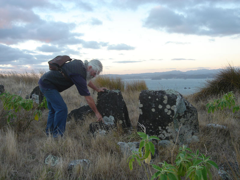
The standing stones noted by the New Zealand Archaeological Association in 1979 are inspected by engineer-researcher, Barry Taylor during New Zealand's Autumn Equinox, 2013. He points to purpose placed foundation stones that wedge and lock the upright marker-boulder solidly into a permanent standing position.
This was a very common practice throughout ancient New Zealand, with many large obelisk solar observatory boulders sitting in carefully built stone cradles, which strongly supported the base and ensured ongoing stability.
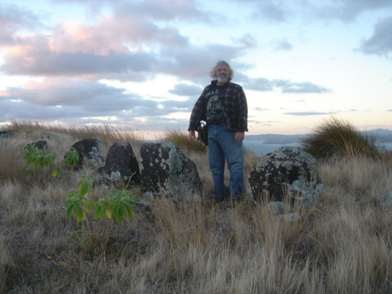
The author amidst the line of enigmatic, purpose-erected standing stones that were observed and recorded by astute archaeologists in 1979. Sadly, since that time, the existence of the many hundreds of standing stone arrangements across the landscape of New Zealand have become an "unmentionable" in archaeological literature, as any such acknowledgement would provide "unwanted" empirical evidence concerning the ancient "Surveyor" populations that occupied New Zealand for thousands of years before the coming of the Polynesian-Melanesian Maori warriors.
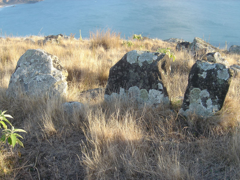
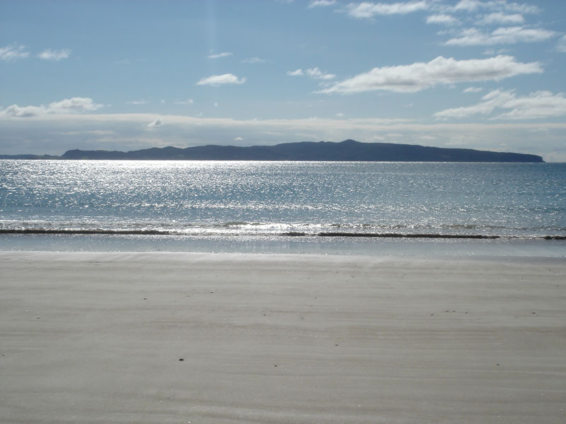
Another view of the stones, looking northwards over Opito Bay towards Mercury Island.
TAHANGA HILL'S HUBSTONE & THE WINTER SOLSTICE.
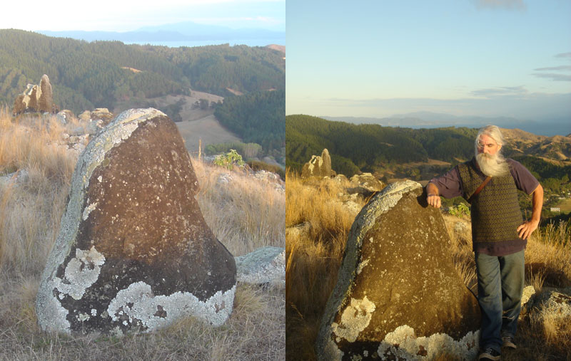
Centrally located on the hill-crown is this very impressive, sharks-fin shaped stone, which has obviously been purpose-placed directly onto the volcanic soil and has not naturally occurred at that spot. Its wide, flat base assures that it is very stable in this upright position.
As it turns out, there are many purpose-placed standing stones on Tahanga Hill's summit, as well as very large, natural outcrops (especially on the southern side of the crown). It appears obvious that tutorials related to navigation and cyclic astronomy were conducted on the hilltop and future, careful archaeological and surveying investigations would undoubtedly tell us the purpose for each standing stone position ... sitting at coded distances and angles away from the central hubstone.
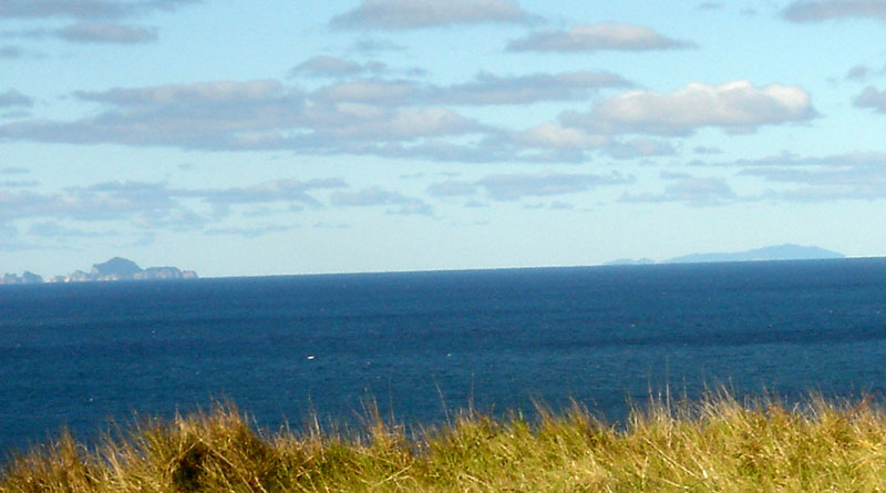
In the above pictures, the vague outline of majestic Moehau Mountain can be seen sitting 26-miles away behind and above the hubstone.
Moehau Mountain's position @ 300-degrees WNW of the hubstone marks the alighting position of the Sun on the day of the Winter Solstice.
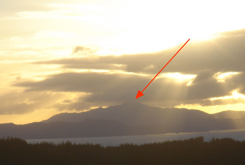
With the observer standing at the hubstone on Tahanga Hill on the day of the Winter Solstice, the late afternoon Sun begins its descent towards the summit of majestic Moehau Mountain and finally alights perfectly onto the high peak.
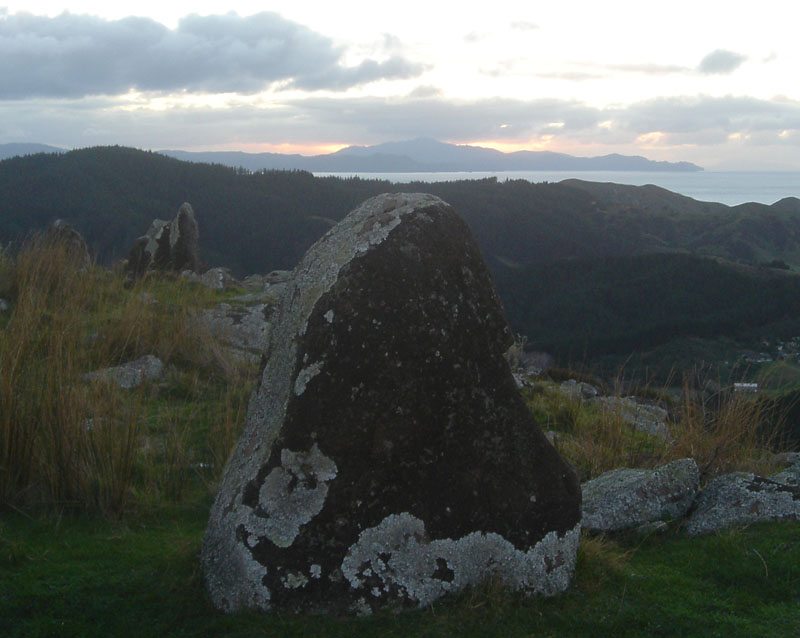
The Winter Solstice Sun has, moments before, hit the peak of Moehau Mountain, as witnessed from the hubstone position, and sunk down behind, illuminating the mountain with its afterglow. By this precise annual fix, the ancient astronomer-surveyors atop Tahanga Hill could keep their calendars 100% accurate to the day, using the peak of Moehau mountain as the outer-marker for that important solar event.
Although dynamic solar observatories such as this, pre-dating the epoch of the Polynesian Maori by thousands of years, are everywhere present across the New Zealand landscape, our "conformist" archaeologists (trained not to see or mention this "in-plain-sight" evidence) will never divulge these "unmentionable" truths to the general public concerning New Zealand's long-term history.
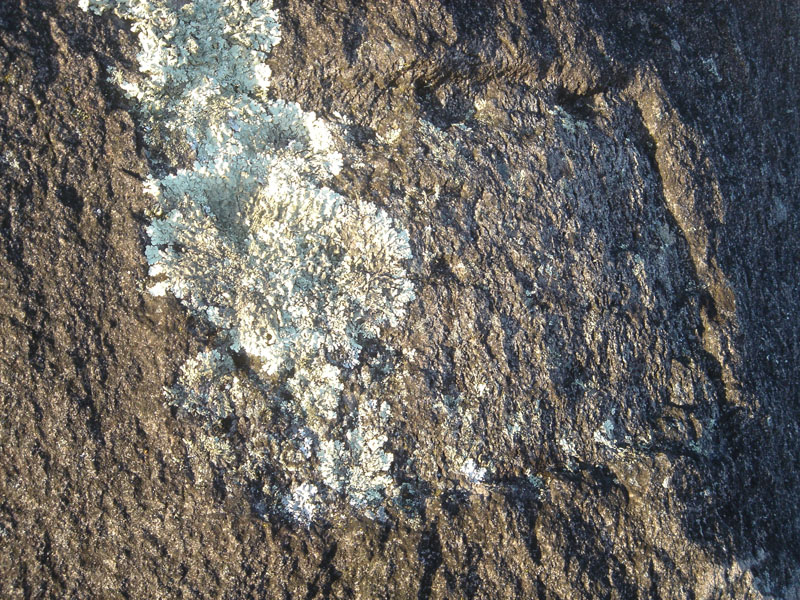
On the northern side of the hubstone is an unfinished, pecked-out "square" incised into the stone. The depression does not appear to have been done with a steel chisel, but gives the appearance of having been done with a stone adze. There are no screw or anchor holes in evidence to suggest that a modern-day brass plaque was once attached within the rough-hewn square.
The square faces "due North" and orientates onto the high, northern coastline ridge of Mercury Island, approximately the highest point of the island but co-equal in elevation to a more central hump hill on Mercury Island.
THE OUTER-MARKER FOR THE EQUINOX SUNRISE
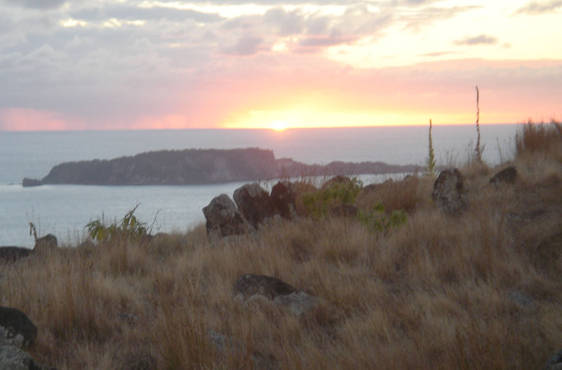
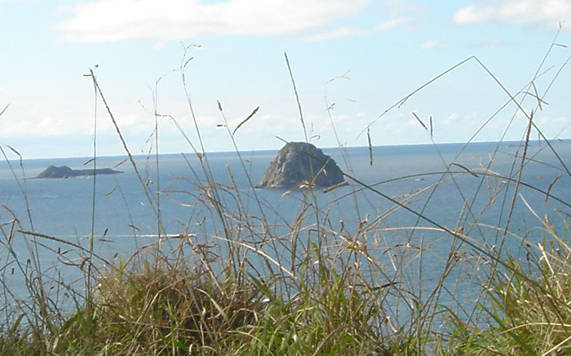
From the hubstone atop Tahanga Hill, the "first-glint" of the equinoctial sunrise occurs on the sea horizon precisely in line with the "notch" on Ohinau Island. This gives a very refined fix on the exact day of the Equinox and could be checked every six-months (vernal and autumnal equinoxes) in order to keep calendars running true.
Because of the elevated position of Tahanga Hill's crown above sea level the "first glint" of the rising sun occurs at 91.75-degrees from the hubstone atop the hill.
Alternatively, the highest "hump" position of Ohinau Island (a position 1.75-degrees North of the equinox sunrise dissection of the island) would represent due East and could be used as a benchmark fix for the 90-degrees azimuth angle. From that permanently available, outer-marker landmark fix, the exact degree angles to any other targets around the horizon could be calculated precisely from Tahanga Hill's hubstone.
In the central zone of the above picture the standing stones recorded by archaeologists in 1979 can be seen sitting just below Ohinau Island.
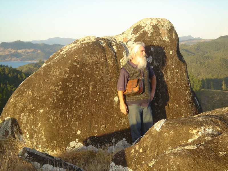
Barry leans against the largest natural outcrop, situated on the southern side of Tahanga Hill's summit. It is eerily "Sphinx-like" in shape and like "Lion-Rock" at Piha of New Zealand (facing West) or the Great Sphinx of Egypt (facing East), orientates towards equinox rise or set positions (as Barry's shadow shows with the early rising equinoctial Sun, casting a shadow westwards).
It's possible that the otherwise natural feature might have been partially shaped for effect in ancient times, like many other known outcrops or hewn-out cliff-face images to be found around New Zealand.
Lower down the hill there are also many such natural outcrops. However, amidst it all on the summit the ancient surveyors also erected a free-standing central hubstone, as well as many standing stone outliers that were directly related to the hubstone by predetermined distances and angles.
MOEHAU MOUNTAIN
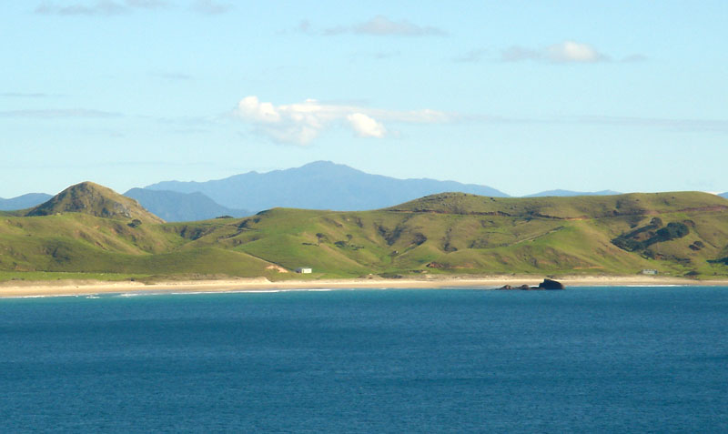
Rising majestically above Opito Bay is Moehau Mountain, the peak of which is situated 26-miles distant and the highest point of the entire Coromandel Range.
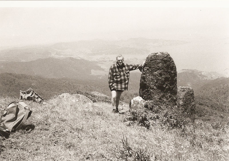
Just like Tahanga Hill at Opito Bay, the top of Moehau Mountain is also crowned with an ancient standing stone trig, as well as scattered satellite marker boulders that now lie recumbent. Photo taken by Dennis Hamblin, Takapuna, Auckland, 1979. The view is South towards the Firth of Thames. Photo and supportive details supplied from the archives of researcher, Gary Cook.
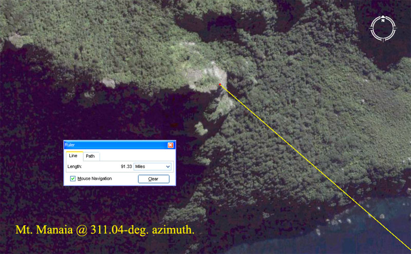
For ancient surveyors taking angle and significant solar fixes from atop Tahanga Hill, Opito, the looming position of distant Moehau Mountain's high peak represented the primary benchmark for precisely setting up alidade sighting rules (the ancient equivalent to modern theodolites). Moehau Mountain's peak sat at exactly 300-degrees azimuth (5/6ths of 360-degrees). By adjusting a simple calibrated disc, marked in 360-degree segments, to achieve a reading of 300-degrees for Moehau peak, the angle off North to all other targets on the horizon could be known precisely.
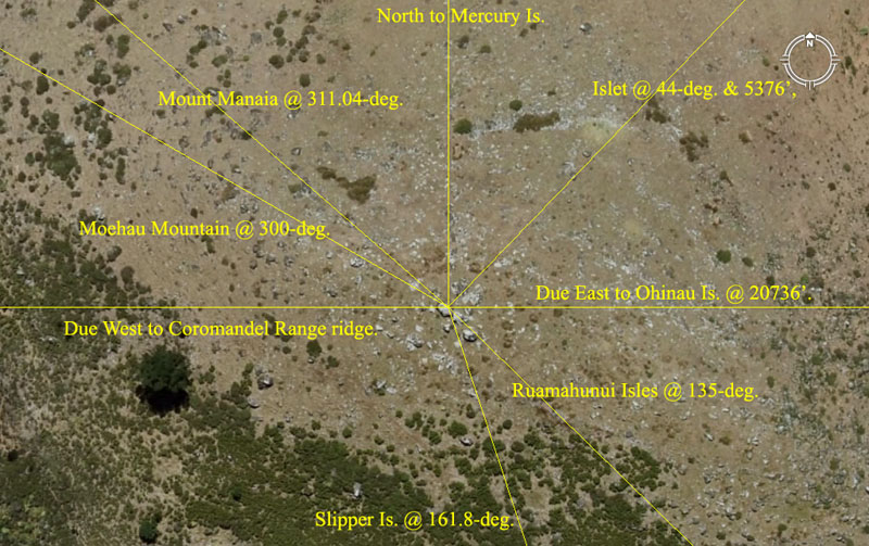
The hubstone atop Tahanga Hill is ideally situated to relate, in a dynamic surveying sense, with several outlying targets simultaneously and it's obvious that this benchmark position was chosen with great care.
As stated, from the hubstone on Tahanga Hill, the high-point atop Ohinau Island represented due East and the "notch" adjacent was the sunrise position at the equinox. The due East position could be interpreted (by triangulations) to sit a coded 20736' (248832-inches) from the Tahanga Hill hub or 1/6300th of the 24883.2 Greek mile equatorial circumference of the Earth.
Note: the largest Egyptian Royal Cubit was 20.736" (2092/125ths) and acted as a mnemonic device for remembering the equatorial circumference of the Earth (24883.2 ÷ 2073.6 = 12).
Here are some glimpses into how factorable numbers like 20736 were anciently used to encode deeply profound scientific principles:
