THE SEMI-CIRCLE OF DISTANT SHAFTS ASSOCIATED WITH DURRINGTON WALLS HENGE
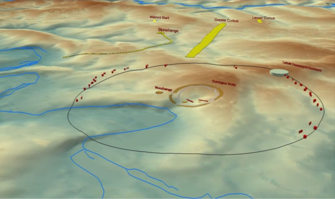
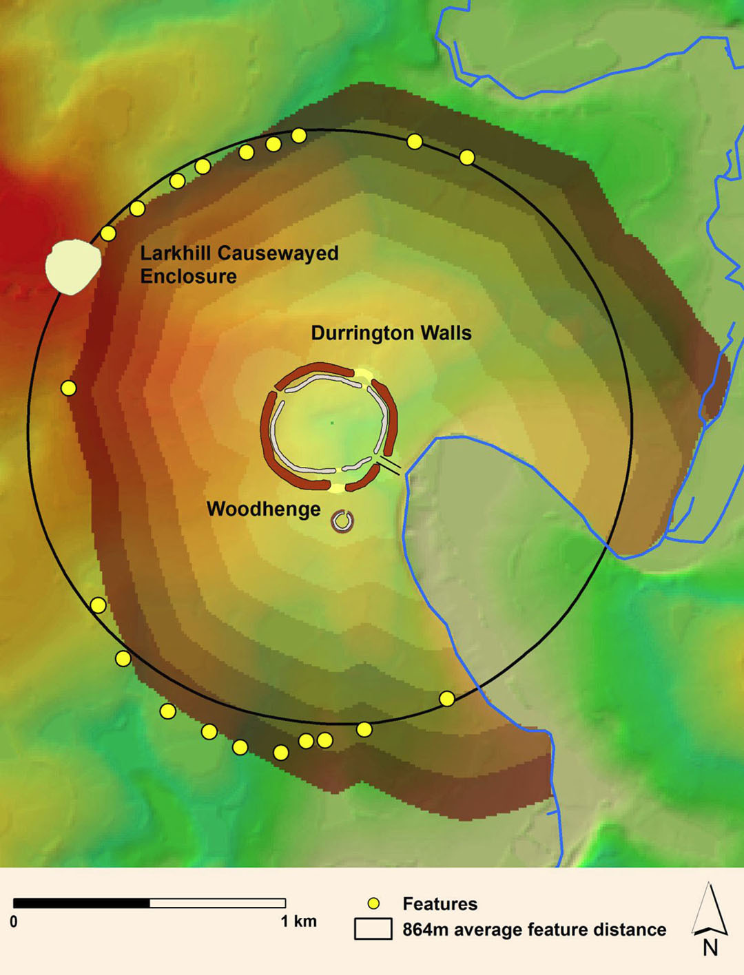
The discovery of 20 formerly wide and deep shafts, situated an average of 864 metres (2835-feet), away from the centre of Durrington Walls Henge, Southern England, is considered by many to be the find of the century and a huge archaeological achievement.
Archaeology researcher Andrew Collins writes:
'The recent discovery of an enormous ring of cylinder-like pits, each approximately five meters deep and 10 meters in diameter, found to encircle the henge enclosure of Durrington Walls in Wiltshire, southern England, is set to become one of the greatest enigmas of British archaeology. With a maximum diameter of 1.44 miles (2.31 kilometers), this huge circular feature, discovered by the Stonehenge Hidden Landscapes Project and henceforth to be known as Durrington Shafts, is now officially the largest prehistoric monument of its kind anywhere in the world. The fact that it is located just 2 miles (3 kilometers) from Stonehenge only adds to the mystery'.

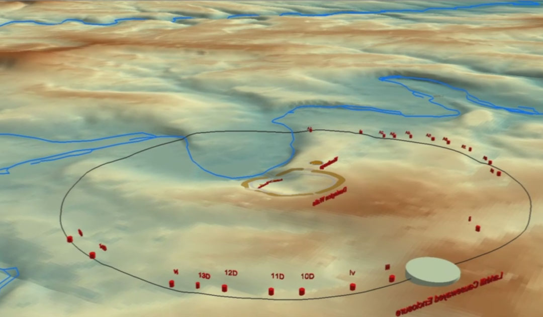
Two views of the distribution of shafts, situated somewhat erratically, but averaging 864-metres (2835-feet) away from Durrington Walls Henge. Images taken from an animated video found at: https://intarch.ac.uk/journal/issue55/4/index.html
SO, WHAT COULD THESE POSSIBLY BE FOR?
This researcher has studied Durrington Walls Henge, and many other similar sites, like Avebury Henge in southern England, Dowth Henge in Ireland, as well as standing stone circles like Brodgar in Scotland or others situated throughout Great Britain, as elsewhere, and has concluded that they functioned as ancient "Open-Air-Universities".
Standing away from the centres of the above mentioned sites were all manner of erected markers, some many miles distant in the outer landscape. These structures were, variously, chambered cairns for shelter in the severe cold of the Orkney Islands, or mounds, obelisks, arrays of standing stones, post complexes, barrows, souterrain tunnel dwellings, etc., and each structure would reside at a coded distance and angle from the henge's or standing stone circle's centre.
The primary or most important function of these Open-Air-Universities was in teaching navigation to the brightest and the best of British, Continental European or Mediterranean youth, who were sent to Britain, even in remote antiquity, to train for many years as a precursor to becoming navigators on ancient ships, plying their trade routes across the vast, featureless oceans.
In an age where very perishable books of paper or scrolls of papyrus, parchment, etc., were in short supply, highly significant scientific principles, related to the equatorial size of the Earth or solar, lunar and stellar cycles, had to be encoded into a special parcel of number strings, then memorised with severity.
The method used was to set up standing stone circles and similar cart-wheel -type sites, composed of a central hubstone, then numerous outlier positions. Every distance and angle relationship between the hubstone and an outlier marker generated a distance value and an angle around from north and it was within these two numbers that profound ancient sciences were encoded. All one needed in order to extract the special numbers was a precise measurement system and a 360-degree calibrated disk, as well as specific geological features on the skyline that sat at a known primary or secondry point of the compass away from the hubstone.
Thereafter each generation of highly-trained "masters of the craft" or seasoned savants had an absolute responsibility to teach the ensuing generation the entire parcel of numbers and their scientific meanings, otherwise they had just cursed their children and the concept of abundant, working civilisation could slip from the grasp of descendants and be lost forever.
The henges and giant standing stone circles like Brodgar were centres where intense orienteering training was given. The students, in small groups, were assigned quests, based upon measured distances and angles to a series of outlier targets in every direction around the henge or hubstone centres and had to, over a period of days, find their way each day to target standing stones or mounds etc., some lying miles away in the outer landscape. With the onset of night, the final target for the day would be a chambered cairn or souterrain where the small groups could shelter, rest, eat & sleep in relative comfort and warmth. Failure to find that all-important day's-end objective meant a bad night out in the cold with wolves or bears, etc., so accurate navigation was paramount.
At the big henge complexes like Durrington Walls or standing stone circles like Brodgar, there are literally hundreds of purpose-built, precisely-positioned structures scattered around for miles in the outer landscape. Any number of varying orienteering quests were possible and students spent years, circuiting out and back on various quests, honing their navigational skills on land before being entrusted with a ship and crew and going to sea.
The so-called Greek myth about Theseus slaying the Minotaur in the Labyrinth is in similitude or analogous to ancient students of navigation training at the many henge complexes, traipsing between associated outlier structures as apprentices, before venturing out upon the cruel and unforgiving oceans that were intent upon devouring those insufficiently trained in the navigational arts. Only the very best navigators, adept in positional plotting and dead-reckoning, had any hope of escaping from the monster of the deep that lurked beneath in the oceanic labyrinth, thus preserving their own lives, crew and precious cargo under the navigator's guidance, care and keeping. See: http://www.celticnz.co.nz/Brodgar/Brodgar%202.htm
The circuiting embankment walls of the henges represented an artificial sea horizon and students, with a fix point for true north, would spend many long nights clustered together at the henge centre memorising the rise and set angles or swirl sequences/ positions of bright navigational stars and constellations, as well as the movements of the moon and morning sunrise positions. The sun, rising through a constellation background of stars, gave an accurate time-fix on the month of the year. The phase of the moon was all important to navigators who, if encountering stormy, cloud-shrouded weather, and thereby lost track of the date, could look at the moon when conditions cleared and accurately determine the date.
The sciences encoded by number strings or progressions were for grid referencing the Earth for successful positional plotting and dead reckoning, They were also used for monitoring the duration of the lunar nutation cycle and tracking both the sun and moon positions under the Sabbatical lunisolar calendar system, counting days, weeks, months and years. The ages-old sexagesimal chronology system, known to be used by the Sumerians, was in widespread use, along with the 360-degree angle system. The scientific numbers derived from the special parcel were used in all weights, measures and volume standards and these were either shared by or in precise ratio to the standards of cousin nations.
All of the cubits, feet, miles, leagues, talents of weight (grain counts) or volumes (cubic inches) standards had to precisely exhibit one of the special scientific numbers and this was absolutely adhered to by the great civilisations of the Mediterranean and Continental European/ British Isles people of antiquity.
The big secret for decoding ancient standing stone circles or henge complexes of Britain is to use the British standard inch and foot, as well as the 360-degree angle system. This measurement system is not British in origin and is found within more ancient, far removed, purpose built and positioned structures over several continents, some of which pre-date British civilisation. The use of these selfsame, standard inch & foot increments ranges from Egypt and its environs to the Americas and beyond. See: http://library.cincymuseum.org/journals/files/jcsnh/v09/n2/jcsnh-v09-n2-ind-051.pdf
As stated, at henge complexes or standing stone circles each outlier away from the centre hub will produce a number related to its distance and another related to its angle around from north. Both forms of derived values are number codes. The same holds true of Continental European and Mediterranean sites or others on far-flung continents across the world, all the way to New Zealand at the far ends of the Earth.
So, with that and all the foregoing in mind, let's explore what the Durrington Walls shafts were built for.
With each and every structure in the outer landscape around the henge relating back, in a surveying sense to the centre hub by coded distance and angle numbers, it doesn't take much of a stretch of the imagination to consider that the lately discovered shafts encircling Durrington Walls Henge were, equally, markers of specialised code-bearing positions.
THE CENTRE OF DURRINGTON WALLS HENGE
Firstly, we've got to determine the position that constituted the architecturally designed, centre position or benchmark of Durrington walls Henge and our archaeologists have never actually provided this definitive information with absolute precision. Ancient society, before commencing building the huge, encircling embankment walls would have indelibly marked the centre of the site and there should be extant evidence of the position somewhere under the topsoil. It's crucial to find that spot before attempting to decipher what the henge was used for, as the distance and angle to all outliers resolve back to that spot.
Like at Avebury Henge, there should have been a very tall obelisk or post marking a circle centre, the height of which was well above the henge embankment walls and viewable from far-off. At Avebury Henge, a tall obelisk at the centre of the southern circle reached about 17-feet into the air and could be seen for miles away, from many vantage points around the outer landscape.
As stated, Henges or standing stone circles will always be positioned based upon a primary or secondary point of the 360-degree compass. Somewhere on the horizon there will be a geological feature (mountain peak or prominent "V" in the landscape, etc.) that gives a very accurate reading on due north, south, east or west or the secondary positions of 45, 135, 225, 315-degrees respectively. This is an absolute rule ... no such complex can function unless very accurate degree angles are obtainable from a marked benchmark centre that orientates onto eternally intact, outlying geological features situated at primary or secondary points of the compass.
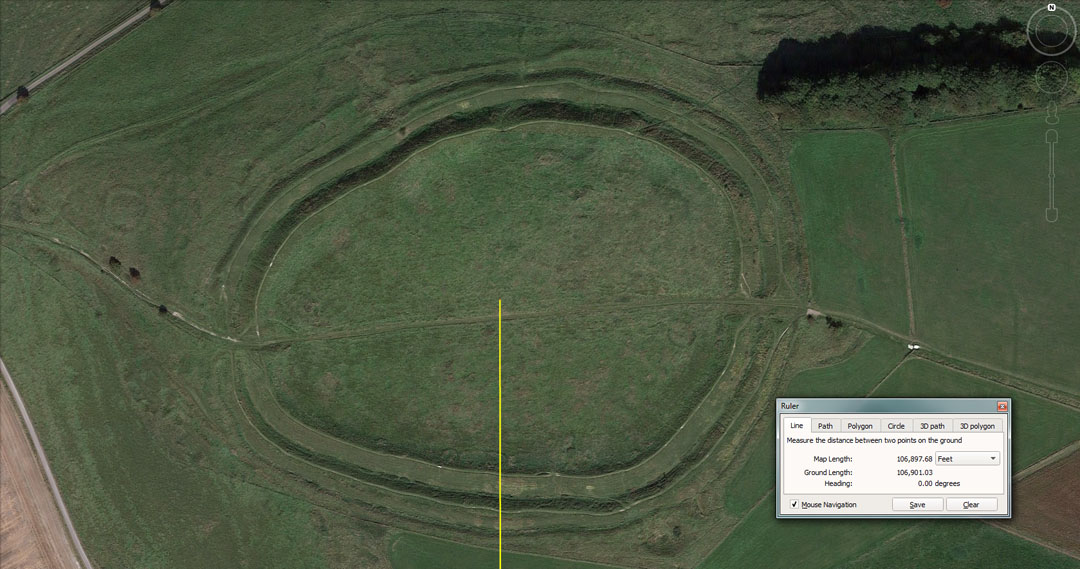
Barbury Castle, considered to be a hillfort from the Iron Age, sits perfectly due north (360-degrees), centre-to-centre, from Durrington Walls Henge. This hillfort is located on the high Ridgeway (861-feet elevation), with commanding views and wide vistas in all directions. Due to its very elevated position, 20-miles to the north, it should have been detectable from the henge embankment or a close-by interim hill. The henge embankment sits at 351-feet above sea level, whereas Barbury Castle hill achieves 500-feet of additional height.
Note: multiple images throughout this study are courtesy of Google Earth.
The surveying evidence would suggest that the architectural and surveying choice of epicentre position for constructing Durrington Walls Henge was fully contingent upon the crown of this high northern hill near Swindon.
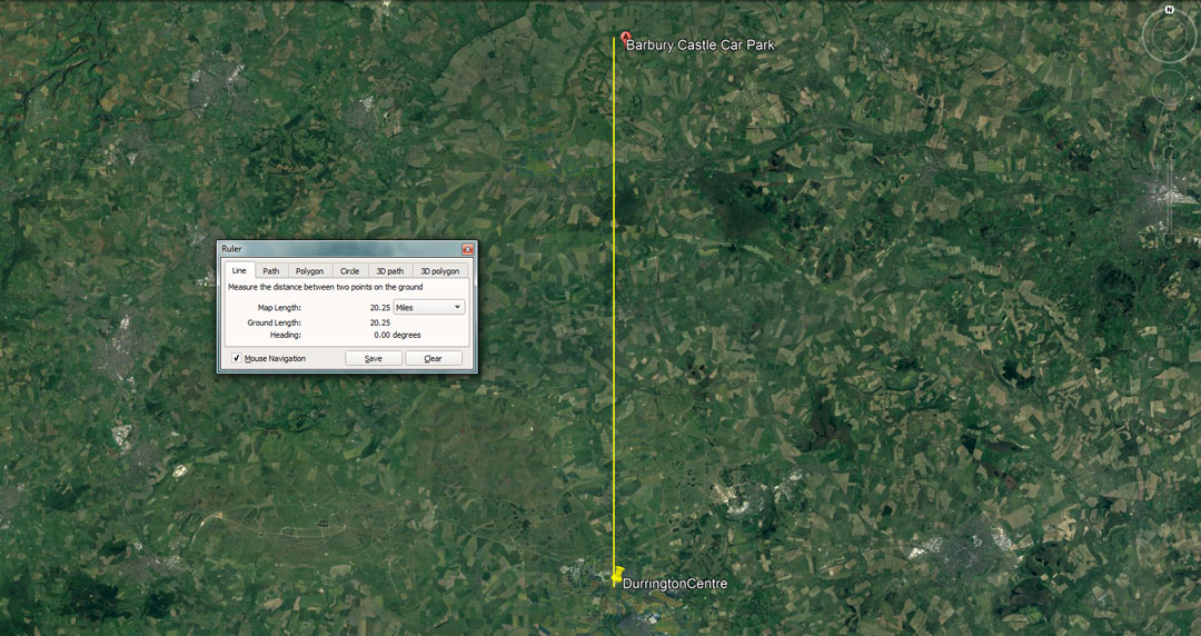
The due north line.
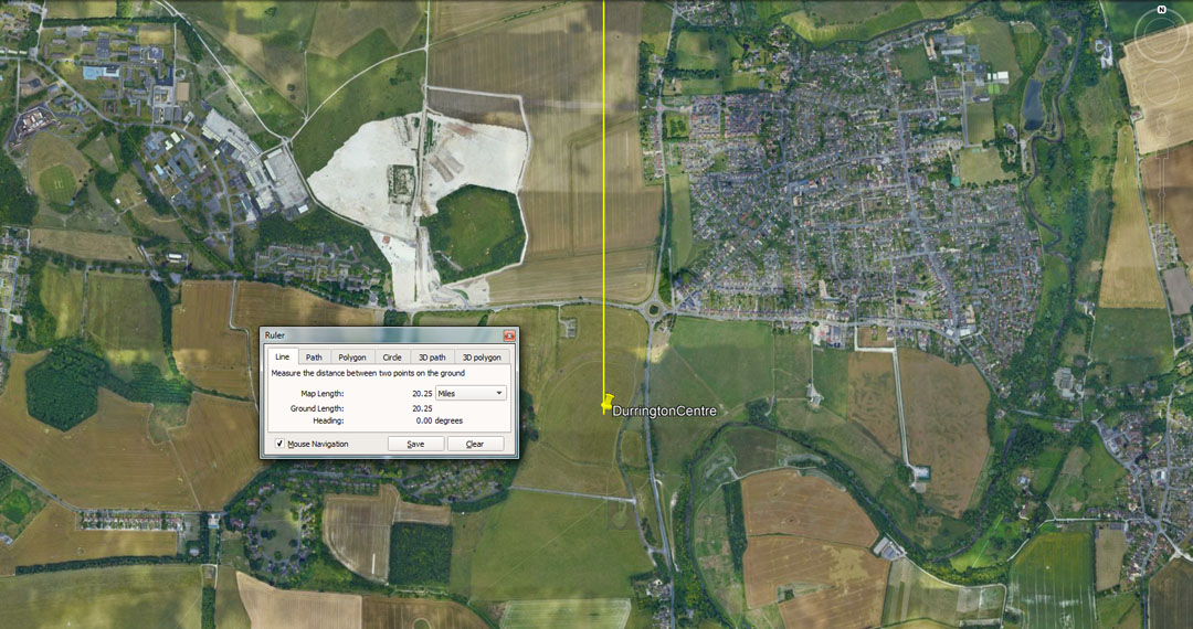
And from the middle of the Durrington Walls field.
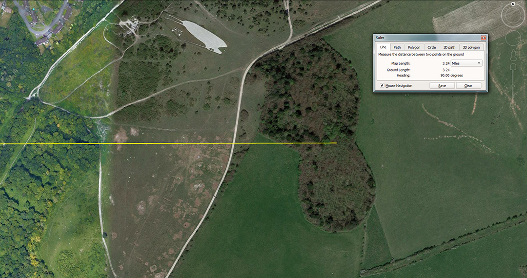
The easting for Durrington Walls Henge appears to have been the centre dip of this hill 3.24-miles due east.
Where the northing and easting lines cross at Durrington Walls Henge would have established the surveying epicentre from which the entire henge was set out and built. There would have, undoubtedly, been both easting and northing markers (posts/obelisks) erected on the embankments of the henge for accurate, ongoing 360-degree orientation from the centre in all weathers. This easting hillock is about 200-feet higher than the terrain around it and 250-feet higher than the henge wall.
The true centre, based upon the northing and easting fixes should reside at approximately 51 11 32.95 N 1 47 11.54 W
To see a similar surveying modus operandi in play at Dowth Henge in Ireland see: http://www.celticnz.co.nz/KnowthNewgrange/Part1.html
For its northing, the centre of Dowth Henge fixes onto high Slieve Gullion Mountain peak in County Amagh.
THE PRECISE COORDINATE POSITIONS OF THE DURRINTON WALLS OUTER SHAFTS
There are no published coordinate figures to be found on the Internet for the 20 positions of newly found shafts circuiting Durrington Walls from the north to the west to the south. There are, however, very accurate map drawings of the shaft positions and these have been embedded as transparencies into Google Earth, then sized with care to fit roads, rivers, buildings and other prominent landmark features, sufficient to attain excellent placement accuracy.


The Google Earth tool for embedding these maps as transparencies, then manipulating them for very accurate overlays can be found at:
https://www.google.com/earth/outreach/learn/creating-photos-image-overlays-in-google-earth/